Callahans Hills in Pittsylvania County, Virginia — The American South (Mid-Atlantic)
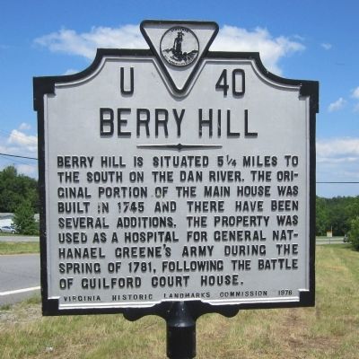
Berry Hill
Erected 1976 by Virginia Historic Landmarks Commission. (Marker Number U-40.)
Topics and series. This historical marker is listed in these topic lists: Colonial Era • War, US Revolutionary. In addition, it is included in the Virginia Department of Historic Resources (DHR) series list. A significant historical year for this entry is 1745.
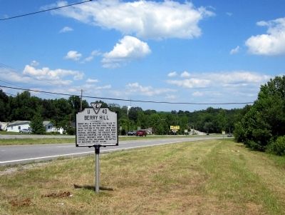
Location. 36° 36.264′ N, 79° 31.363′ W. Marker is in Callahans Hills, Virginia, in Pittsylvania County. Marker is on Martinsville Highway (Business U.S. 58) 0.3 miles east of Berry Hill Road (U.S. 311), on the right when traveling east. Touch for map. Marker is in this post office area: Danville VA 24541, United States of America. Touch for directions.
Other nearby markers. At least 8 other markers are within 7 miles of this marker, measured as the crow flies. Rockabilly Pioneer Janis Martin (approx. 4.9 miles away); Schoolfield (approx. 6 miles away); Averett University (approx. 6.4 miles away); World War I Memorial (approx. 6.6 miles away); Veterans Memorial (approx. 6.6 miles away); The A.J. Montague House (approx. 6.6 miles away); Andrew Jackson Montague (approx. 6.6 miles away); The Langhorne House (approx. 6.8 miles away).
More about this marker. There is another Commonwealth of Virginia marker with this same number but with no relation to this marker. The other U-40 marker is titled “Patrick Henry’s Leatherwood Home” on U.S. 58 at the interchange with U.S. 58 business east of Martinsville.
Also see . . . Berry Hill. National Register of Historic Places (Submitted on November 11, 2021.)
Credits. This page was last revised on November 11, 2021. It was originally submitted on June 16, 2013, by Bernard Fisher of Richmond, Virginia. This page has been viewed 697 times since then and 53 times this year. Photos: 1, 2. submitted on June 16, 2013, by Bernard Fisher of Richmond, Virginia.

