Oakley in Logan County, Kansas — The American Midwest (Upper Plains)
Inhabitants of the Kansas Plains
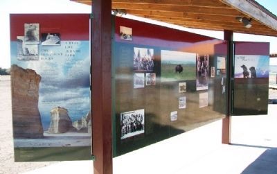
Inscription.
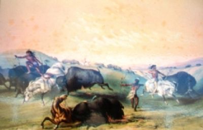
At the end of the Ice Age, about 9000 years ago, people hunted wooly mammoths and ancient bison on the plains of what is now Kansas. They used spears and atlatls, or throwing sticks, and they made beautiful stone points from native flint. They were migratory and did not live in permanent settlements.
About 2200 years ago, ancestors of the modern Pawnee Indians moved from the eastern woodlands onto the plains and into the river valleys of western Kansas. They brought new technologies with them -- bows and arrows, pottery, and a knowledge of farming. They also followed the buffalo, but they built earth lodges and grew crops.
By 1500, Atapaskan people (called "Apaches" by the Spanish) had moved into western Kansas. They also hunted and, to a lesser extent, engaged in farming.
There are many places, natural features of beauty or starkness, that they called sacred. Kansas was not just a hunting ground. It was truly "home" to the native peoples.
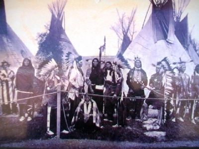
The Comanche people of the central plains and Rockies were among the first Indians to master the horse. By 1706 they had moved into what is now Kansas and had conquered or driven out the Apaches. Their rule of the prairie buffalo country led other people to call them "Lords of the Plains."
But by 1800, their lordship of western Kansas was contested by the Sioux, the Arapaho, and especially the Cheyenne.
Life became more complicated for the Indian people of Kansas after 1830 when the U.S. Congress passed the Indian Removal Act. The government began forcing Indian people in the eastern states to give up their lands in exchange for land beyond the Missouri River. Soon there were Shawnee, Kickapoo, Delaware, Miami, Ottawa, and other tribes competing for resources in Kansas.
After the Civil War, many of the tribes in Kansas were forced once again to move, this time to Indian Territory (Oklahoma).
The Kansas-Nebraska Act of 1854 opened Kansas to white settlement. Though the government attempted to make treaties with most of the Indian tribes in the territory, many of the Indian peoples, naturally, did not want to give up their homes.
In 1857, in response to Comanche raids, General Edwin V. Sumner led the first military expedition against Indians in western Kansas. When Col. John Chivington commanded militia troops in the brutal massacre of a peaceful Cheyenne camp at Sand Creek in nearby Colorado, warfare broke out all over the central plains. The army was forced to establish a series of forts including, in 1865, Fort Hays (80 miles east of Oakley) and Fort Wallace (43 miles west of Oakley).
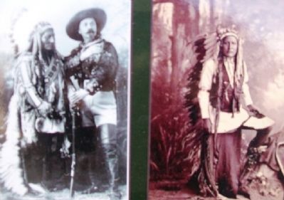
Col. George A. Custer campaigned here in 1867 and 1868. Scouts such as Buffalo Bill Cody, Wild
Bill Hickok, and Medicine Bill Comstock guided cavalry expeditions through the Smoky Hill country.
After fifteen years of repeated hostilities throughout the Smoky Hill region, chiefs Little Wolf and Dull Knife led one last escape of Cheyenne people from captivity in Indian Territory to their northern plains homelands. They passed through what is now Logan County as they eluded the cavalry. Though not bloodless, their trek won the admiration of some in the eastern press and ended a dramatic chapter in the taming of the American west.
Erected by Wild West Historical Foundation and the Kansas Humanities Council.
Topics. This historical marker is listed in these topic lists: Animals • Environment • Native Americans • Wars, US Indian.
Location. 39° 7.611′ N, 100° 52.156′ W. Marker is in Oakley, Kansas, in Logan County. Marker is at the intersection of U.S. 83 and 2nd Street, on the left when traveling north on U.S. 83. Marker is in the kiosk adjacent to the Buffalo Bill Cultural Center. Touch for map. Marker is at or near this postal address: 3083 US Hwy 83, Oakley KS 67748, United States of America. Touch for directions.
Other nearby markers. At least 8 other markers are within walking distance of this marker. Annie Oakley (here, next to this marker); The Monument Rocks (here, next to this marker); The Smoky Hill River Valley - Buffalo Country
(here, next to this marker); Early Exploration across Kansas (here, next to this marker); Oakley: Birthplace of the Legend (here, next to this marker); The Great Buffalo Hunt (here, next to this marker); Buffalo Bill Cultural Center (within shouting distance of this marker); Logan County Sandstone (approx. 0.4 miles away). Touch for a list and map of all markers in Oakley.
Related marker. Click here for another marker that is related to this marker.
Also see . . .
1. American Indians in Kansas: A Bibliography. (Submitted on June 18, 2013, by William Fischer, Jr. of Scranton, Pennsylvania.)
2. American Indians in Kansas. (Submitted on June 18, 2013, by William Fischer, Jr. of Scranton, Pennsylvania.)
3. Sand Creek Massacre National Historic Site. (Submitted on June 18, 2013, by William Fischer, Jr. of Scranton, Pennsylvania.)
4. Battle Canyon 1878 on YouTube. (Submitted on June 18, 2013, by William Fischer, Jr. of Scranton, Pennsylvania.)
5. Indian Removal Act: Primary Documents in Amercan History. (Submitted on June 18, 2013, by William Fischer, Jr. of Scranton, Pennsylvania.)
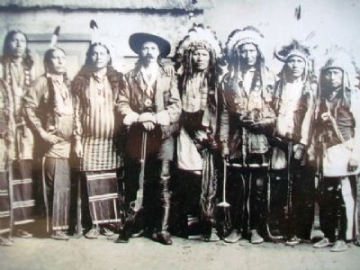
Photographed By Unknown, 1886
4. Photo on Inhabitants of the Kansas Plains Marker
Credits. This page was last revised on August 6, 2021. It was originally submitted on June 18, 2013, by William Fischer, Jr. of Scranton, Pennsylvania. This page has been viewed 623 times since then and 10 times this year. Photos: 1, 2, 3, 4, 5. submitted on June 18, 2013, by William Fischer, Jr. of Scranton, Pennsylvania.
