Pigeon Forge in Sevier County, Tennessee — The American South (East South Central)
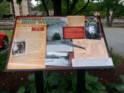
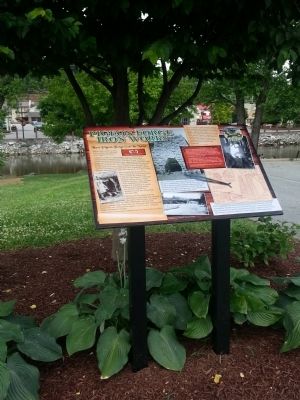
Pigeon Forge Iron Works
How Pigeon Forge Got Its Name
Countless numbers of wild passenger pigeons gathered at this natural habitat of abundant beech and oak trees. Their sheer numbers broke the tree branches. The name “Forge” in Pigeon Forge came from the bloomary forge, adjacent to the Old Mill, built by Isaac Love in 1817. By 1820 he used 100 tons of “pig metal” to manufacture bar iron, in great demand, valued at $9,600. His operation consisted of five employees, two “waterblasts” and one hammer. Historians believe the entire operation was in this vicinity.
The ore was mined from 1817 to early 1830s at several locations near present day Ridge Road, northeast of the furnace. Years later, children walking the river banks found hard pieces of slag, remnants of the smelting process. Older people told of standing on nearby hillsides and thinking that the fires of Hell could burn no brighter or hotter than those from the iron works.
The pig iron was carried from the blast furnace to the forge and reheated. The molten mass of iron was placed under the mighty blow of a 400 to 500 pound water-powered hammer, perhaps made from local iron. The result after reheating and hammering was a merchant bar, about 3”x1½”x4½’, used for hinges, horseshoes and tools.
Captions
Ore was hauled on sleds pulled by oxen or mules along the old Possum Hollow Road through Captain Henry Hollow to the blast furnace, near the forge, where pig iron was made. Fire backs for chimneys were made in the furnace. Skillets, cauldrons, anvils, and flat irons were cast in the sand floor in front of the furnace. Pictured for comparison (Left) is the Bear Spring Iron Furnace in Stewart County, Tennessee.
After the furnace changed hands a few times, John Sevier Trotter purchased the failing Iron Works in 1849, revived it and operated the Pigeon Bloomary Forge until at least 1856 when he manufactured about two tons of merchant bars with one bloomary fire and one hammer driven by water.
The Old Mill General Store sits on the forge site which was first replaced with a water-powered saw mill. The saw mill went out of business and a large grain storage room for the mill was added about 1901.
(Below) This early 1900s dam, upstream from the mill’s concrete dam, is shown in one of the town’s early floods. A similar wooden structure, still upstream, may have been the source of water power for the forge and furnace at some point in its operation. Logs from the dam pictured in this flood are still underwater (2013).
Vast woodlands provided unlimited timber for the charcoal required in smelting. Natural resources included the river, ore and limestone flux. Pictured is an artist’s interpretation of the original Pigeon Forge Iron Works found on a Butler’s Forge Hammer Restaurant menu.
Erected 2013 by City of Pigeon Forge.
Topics. This historical marker is listed in these topic lists: Industry & Commerce • Settlements & Settlers. A significant historical year for this entry is 1817.
Location. 35° 47.272′ N, 83° 33.2′ W. Marker is in Pigeon Forge, Tennessee, in Sevier County. Marker can be reached from Old Mill Avenue, 0.1 miles east of Parkway (U.S. 441). Located behind The Old Mill, beside the parking lot for Patriot Park, near the picnic shelter. It can be seen from a vehicle. Touch for map. Marker is at or near this postal address: 175 Old Mill Ave, Pigeon Forge TN 37863, United States of America. Touch for directions.
Other nearby markers. At least 8 other markers are within walking distance of this marker. Unionists Within the Confederacy (about 300 feet away, measured in a direct line); Early Pigeon Forge (about 600 feet away); Sevier County Veterans Memorial (about 600 feet away); Pigeon Forge Elementary School / Pigeon Forge Canning Factory (approx. 0.2 miles away); First United Methodist Church of Pigeon Forge and Pigeon Forge Academy (approx. ¼ mile away); Pigeon River Railroad (approx. 0.3 miles away); First Baptist Church Pigeon Forge (approx. half a mile away); Broady Dairy (approx. 0.9 miles away). Touch for a list and map of all markers in Pigeon Forge.
Credits. This page was last revised on June 16, 2016. It was originally submitted on June 5, 2013, by Marcia Nelson of Pigeon Forge, Tennessee. This page has been viewed 1,071 times since then and 20 times this year. Last updated on June 19, 2013, by Marcia Nelson of Pigeon Forge, Tennessee. Photos: 1, 2. submitted on June 5, 2013, by Marcia Nelson of Pigeon Forge, Tennessee. • Bernard Fisher was the editor who published this page.

