Woods Of Westlake Heights in Austin in Travis County, Texas — The American South (West South Central)
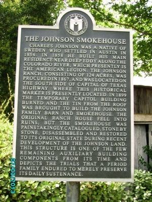
The Johnson Smokehouse
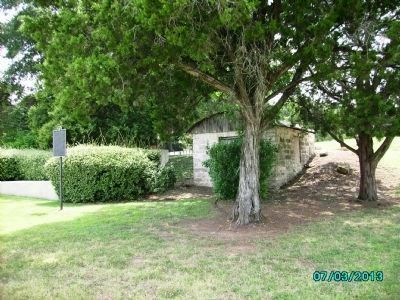
Charles Johnson was a native of Sweden who settled in Austin in 1854. In 1858 he built his main residence near Deep Eddy along the Colorado River, which presently is the American Legion. The Johnson Ranch, consisting of 124 acres, was procured in 1867, and was located on the south side of Capital of Texas Highway where this historical marker is presently located. In 1899 the temporary Capitol building burned and the tin from the roof was brought to build the Johnson family barn and smokehouse. The original ranch house fell into ruins, but the smokehouse was painstakingly catalogued, stone by stone, disassembled and restored to its original state during recent development of the Johnson land. This structure is one of the few remaining auxiliary building components from its time and depicts the trials that a period family endured to merely preserve its daily sustenance.
Erected by Austin Landmark.
Topics. This historical marker is listed in this topic list: Landmarks. A significant historical year for this entry is 1854.
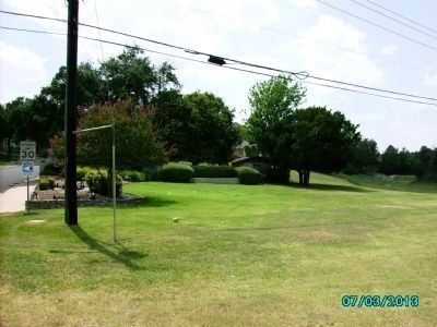
Location. 30° 16.457′ N, 97° 49.099′ W. Marker is in Austin, Texas, in Travis County. It is in Woods Of Westlake Heights. Marker is on Heights Drive near South Capital of Texas Highway (Texas Highway 360), on the right when traveling west . This marker and historic landmark can easily be missed as it hides behind some bushes. Touch for map. Marker is at or near this postal address: 4300 Heights Drive, Austin TX 78746, United States of America. Touch for directions.
Other nearby markers. At least 8 other markers are within 3 miles of this marker, measured as the crow flies. Eanes Cemetery (approx. 0.7 miles away); Eanes School and Chapel (approx. 0.7 miles away); Eanes-Marshall Ranch (approx. 1.1 miles away); Ashford McGill House (approx. 2.6 miles away); James and Leana Walsh House (approx. 2.6 miles away); Deep Eddy Bathing Beach (approx. 2.7 miles away); Swedish Log Cabin (approx. 2.7 miles away); Esperanza School Building (approx. 2.7 miles away). Touch for a list and map of all markers in Austin.
Credits. This page was last revised on February 1, 2023. It was originally submitted on July 2, 2013, by D. Kevin Surbaugh of El Paso, Texas. This page has been viewed 1,089 times since then and 59 times this year. Photos: 1, 2, 3, 4. submitted on July 3, 2013, by D. Kevin Surbaugh of El Paso, Texas. • Bernard Fisher was the editor who published this page.


