Maryville in Nodaway County, Missouri — The American Midwest (Upper Plains)
Maryville
[Front]
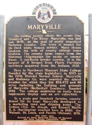
On rolling prairie above the scenic One Hundred and Two River. Maryville was laid out, 1845, as the seat of newly organized Nodaway County. The town is named for its first white woman settler, Mary House Graham, the wife of county official Amos Graham. The county name comes from the Nodaway (Algonquian for snake or enemy) River. A northern border county, it is the largest of 6 formed from Platte Purchase territory acquired from the Indians, 1836.
Here is Northwest Missouri State College founded by the state legislature in 1905 as the Fifth District Normal School. Maryville and Nodaway Co. were awarded the school location for which they bid $58,672 and 86 acres including the building and grounds of Maryville (Methodist) Seminary, founded 1889. The college maintains an early farm implements display and an art collection.
In a grain and livestock farming county, famed for its hogs, Maryville developed as a marketing town and shipping point. The Kansas City, St. Joseph, and Council Bluffs R.R. (Burlington) reach here in 1869; the Wabash, St. Louis, and Pacific (Wabash), 1879.
(See other side)
[Back]
(Continued from other side)
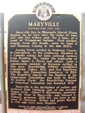
Maryville lies in Missouri's Glacial Plains Region, in an area once the home of Iowa, Sac, and Fox tribes, and, for a time, of a band of Potawatomi Indians. First settlers, largely from the South, came to what is now Nodaway County in the late 1830's.
Among towns settled in Nodaway County is Conception, to the southeast, founded as a Catholic colony by Irish railroad workers from Reading, Pa., under the leadership of Father James A. Power and others. Later a considerable number of Germans settled in this area. Benedictine Fathers established Conception Abbey, 1873, and New Engelberg College, now Conception Seminary, in 1883. The beautiful church of the Basilica of the Immaculate Conception was built in 1880's. At nearby Clyde, the Benedictine Convent of Perpetual Adoration was founded, 1875.
Maryville is the birthplace of author and lecturer Dale Carnegie and the novelist Homer Croy. Albert P. Morehouse, governor, 1887-89, lived in Maryville, and Forrest C. Donnell, governor, 1940-44, was born in the town of Quitman. Writer and jurist Merrill E. Otis was born near Hopkins.
Erected 1957 by State Historical Society of Missouri and State Highway Commission.
Topics and series. This historical marker is listed in these topic lists: Agriculture • Education • Native Americans • Settlements & Settlers. In addition, it is included in the Missouri, The State Historical Society of series list. A significant historical year for this entry is 1845.
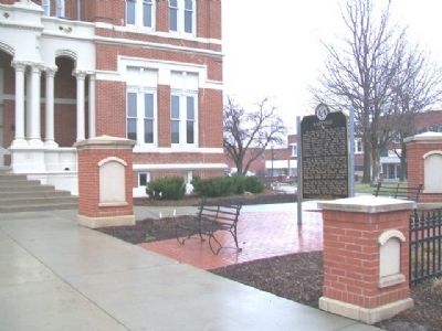
Location. 40° 20.898′ N, 94° 52.357′ W. Marker is in Maryville, Missouri, in Nodaway County. Marker is at the intersection of Main Street (U.S. 71) and 3rd Street (State Route 46), on the right when traveling north on Main Street. Marker is on the west grounds of the county courthouse. Touch for map. Marker is at or near this postal address: 305 North Main Street, Maryville MO 64468, United States of America. Touch for directions.
Other nearby markers. At least 8 other markers are within walking distance of this marker. Nodaway County Courthouse (a few steps from this marker); Nodaway County Veterans Memorial (within shouting distance of this marker); Lanning's Mill Stone (within shouting distance of this marker); First House in Maryville (about 500 feet away, measured in a direct line); Maryville Freedom Rock Veterans Memorial (approx. 0.3 miles away); Northwest Missouri State University Administration Building (approx. 0.7 miles away); Welton Ideker (approx. 0.7 miles away); Sisters of St. Francis (approx. 0.7 miles away). Touch for a list and map of all markers in Maryville.
Also see . . . City of Maryville MO Official Website. (Submitted on July 5, 2013, by William Fischer, Jr. of Scranton, Pennsylvania.)
Credits. This page was last revised on June 16, 2016. It was originally submitted on July 5, 2013, by William Fischer, Jr. of Scranton, Pennsylvania. This page has been viewed 589 times since then and 27 times this year. Photos: 1, 2, 3. submitted on July 5, 2013, by William Fischer, Jr. of Scranton, Pennsylvania.


