Mankato in Blue Earth County, Minnesota — The American Midwest (Upper Plains)
Sibley Park
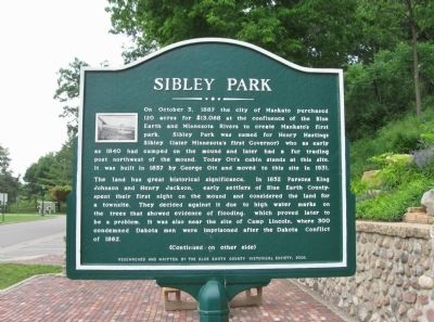
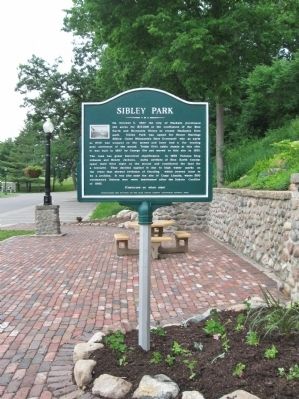
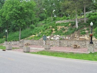
On October 3, 1887 the City of Mankato purchased 120 acres for $13,088 at the confluence of the Blue Earth and Minnesota Rivers to create Mankato’s first park. Sibley Park was named for Henry Hastings Sibley (later Minnesota’s first Governor) who as early as 1840 had camped on the mound and later had a fur trading post northwest of the mound. Today Ott’s cabin stands at this site. It was built in 1857 by George Ott and moved to this site in 1931.
The land has great historical significance. In 1852 Parsons King Johnson and Henry Jackson, early settlers of Blue Earth County, spent their first night on the mound and considered the land for a townsite. They decided against it due to high water marks on the trees that showed evidence of flooding, which proved later to be a problem. It was also near the site of Camp Lincoln, where 300 condemned Dakota men were imprisoned after the Dakota Conflict of 1862.
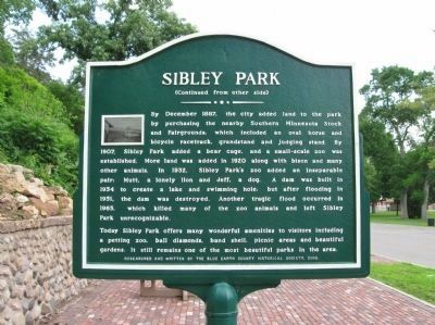
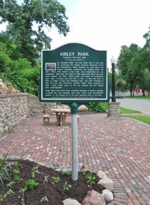
By December 1887, the city added land to the park by purchasing the nearby Southern Minnesota Stock and Fairgrounds, which included an oval horse and bicycle racetrack, grandstand and judging stand. By 1907, Sibley Park added a bear cage, and a small-scale zoo was established. More land was added in 1920 along with bison and many other animals. In 1932, Sibley Park’s zoo added an inseparable pair: Mutt, a lonely lion, and Jeff, a dog. A dam was built in 1934 to create a lake and swimming hole, but after flooding in 1951, the dam was destroyed. Another tragic flood occurred in 1965, which killed many of the zoo animals and left Sibley Park unrecognizable.
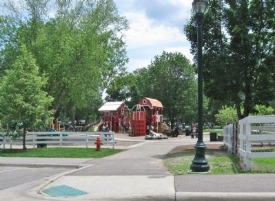
Today Sibley Park offers many wonderful amenities to visitors including a petting zoo, ball diamonds, band shell, picnic areas and beautiful gardens. It still remains one of the most beautiful parks in the area.
Erected 2006 by the Blue Earth County Historical Society.
Topics. This historical marker is listed in these topic lists: Industry & Commerce • Parks & Recreational Areas • Settlements & Settlers. A significant historical month for this entry is October 1941.
Location. 44° 9.655′ N, 94° 1.973′ W. Marker is in Mankato, Minnesota, in Blue Earth County. Marker can be reached from Mound Avenue west of Spence Street. Marker is in Sibley Park. Touch for map. Marker is at or near this postal address: 900 Mound Avenue, Mankato MN 56001, United States of America. Touch for directions.
Other nearby markers. At least 8 other markers are within 2 miles of this marker, measured as the crow flies. Sibley Park World War I (about 600 feet away, measured in a direct line); Ott Cabin (approx. 0.2 miles away); Geology of Minnesota (approx. 0.4 miles away); The First Mahkato Memorial Wacipi (approx. 0.4 miles away); Ho-Chunk / Winnebago (approx. 1.2 miles away); Lincoln Park (approx. 1.3 miles away); Childhood Home of Frances "Bick" Kenney (approx. 1.3 miles away); Kenney House (approx. 1.3 miles away). Touch for a list and map of all markers in Mankato.
Also see . . . Sibley Park. Wikipedia entry. (Submitted on July 5, 2013.)
Credits. This page was last revised on December 9, 2020. It was originally submitted on July 5, 2013, by Keith L of Wisconsin Rapids, Wisconsin. This page has been viewed 1,008 times since then and 41 times this year. Photos: 1, 2, 3, 4, 5, 6, 7. submitted on July 5, 2013, by Keith L of Wisconsin Rapids, Wisconsin.
