Fort Leavenworth in Leavenworth County, Kansas — The American Midwest (Upper Plains)
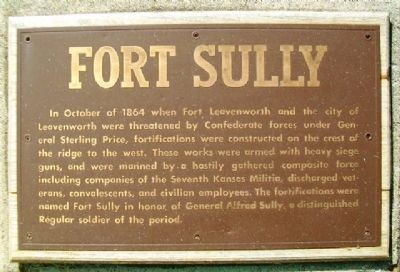
Fort Sully
Topics and series. This historical marker is listed in these topic lists: Cemeteries & Burial Sites • Forts and Castles • War, US Civil. In addition, it is included in the National Cemeteries series list. A significant historical month for this entry is October 1864.
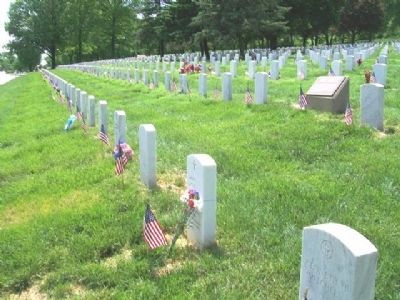
Location. 39° 21.139′ N, 94° 55.758′ W. Marker is in Fort Leavenworth, Kansas, in Leavenworth County. Marker is on Hancock Avenue south of Dixie, on the right when traveling south. Marker is among the headstones in Fort Leavenworth National Cemetery. Touch for map. Marker is in this post office area: Fort Leavenworth KS 66027, United States of America. Touch for directions.
Other nearby markers. At least 8 other markers are within walking distance of this marker. Fort Leavenworth National Cemetery (about 300 feet away, measured in a direct line); Address by President Lincoln (about 300 feet away); Henry Leavenworth (about 400 feet away); Lieutenant John L. Grattan (about 500 feet away); Samuel Turner Shepperd (about 500 feet away); Edward Hatch (about 500 feet away); Henry G. Davis (about 500 feet away); Soldiers Who Died at Fort Larned (about 600 feet away). Touch for a list and map of all markers in Fort Leavenworth.
More about this marker. Public access to the post is possible with proper identification, subject to U.S. Army regulations.
Also see . . .
1. Fort Sully (Fort Leavenworth). Wikipedia entry (Submitted on January 7, 2021, by Larry Gertner of New York, New York.)
2. Fort Leavenworth. U.S. Army website entry (Submitted on January 7, 2021, by Larry Gertner of New York, New York.)
3. Fort Leavenworth National Cemetery. National Cemetery Administration entry (Submitted on July 13, 2013, by William Fischer, Jr. of Scranton, Pennsylvania.)
4. Kansas Forts. Kansas Heritage website entry (Submitted on July 13, 2013, by William Fischer, Jr. of Scranton, Pennsylvania.)
Credits. This page was last revised on January 13, 2022. It was originally submitted on July 13, 2013, by William Fischer, Jr. of Scranton, Pennsylvania. This page has been viewed 607 times since then and 14 times this year. Photos: 1, 2, 3. submitted on July 13, 2013, by William Fischer, Jr. of Scranton, Pennsylvania.


