Nebraska City in Otoe County, Nebraska — The American Midwest (Upper Plains)
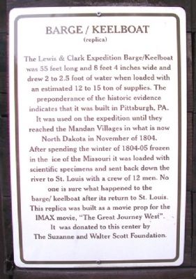
Barge / Keelboat (replica)
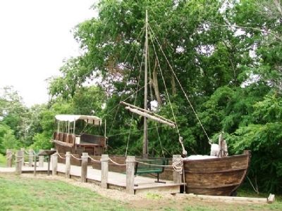
The Lewis & Clark Expedition Barge/Keelboat was 55 feet long and 8 feet 4 inches wide and drew 2 to 2.5 foot [sic] of water when loaded with an estimated 12 to 15 ton[s] of supplies. The preponderance of the historic evidence indicates that it was built in Pittsburgh, PA.
It was used on the expedition until they reached the Mandan Villages in what is now North Dakota in November of 1804. After spending the winter of 1804-05 frozen in the ice of the Missouri it was loaded with scientific specimens and sent back down the river to St. Louis with a crew of 12 men. No one is sure what happened to the barge/keelboat after its return to St. Louis. This replica was built as a movie prop for the IMAX movie, "The Great Journey West". It was donated to this center by The Suzanne and Walter Scott Foundation.
Erected by the Lewis & Clark Missouri River Basin Visitors Center.
Topics and series. This historical marker is listed in these topic lists: Exploration • Native Americans • Settlements & Settlers • Waterways & Vessels. In addition, it is included in the Lewis & Clark Expedition series list. A significant historical month for this entry is November 1804.
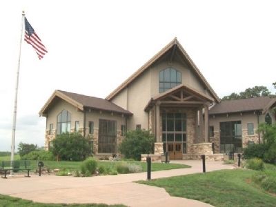
Location. 40° 39.969′ N, 95° 49.853′ W. Marker is in Nebraska City, Nebraska , in Otoe County. Marker and keelboat replica are near the entrance to the Lewis & Clark Missouri River Basin Visitors Center. Touch for map. Marker is at or near this postal address: 100 Valmont Drive, Nebraska City NE 68410, United States of America. Touch for directions.
Other nearby markers. At least 8 other markers are within 2 miles of this marker, measured as the crow flies. Hunter, Watchdog and Faithful Friend (here, next to this marker); Earth Lodge Villages (about 600 feet away, measured in a direct line); The Missouri River (about 700 feet away); Steam Wagon (approx. 1.2 miles away); St. Mary's (approx. 1˝ miles away); Grand Army of the Republic Memorial Hall (approx. 1˝ miles away); First United Methodist Church Original 1855 Wall (approx. 1.6 miles away); Mother Church of Methodism in Nebraska (approx. 1.7 miles away). Touch for a list and map of all markers in Nebraska City.
Also see . . . Lewis and Clark National Historic Trail. (Submitted on July 23, 2013, by William Fischer, Jr. of Scranton, Pennsylvania.)
Credits. This page was last revised on March 20, 2021. It was originally submitted on July 23, 2013, by William Fischer, Jr. of Scranton, Pennsylvania. This page has been viewed 523 times since then and 19 times this year. Photos: 1, 2, 3. submitted on July 23, 2013, by William Fischer, Jr. of Scranton, Pennsylvania.


