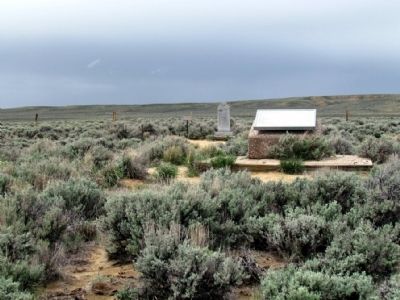
Near Farson in Sublette County, Wyoming — The American West (Mountains)
The Parting of the Ways
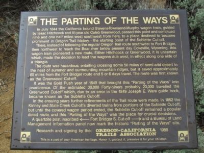
In July 1844 the California bound Stevens-Townsend-Murphy wagon train, guided by Isaac Hitchcock and 81-year old Caleb Greenwood, passed this point and continued nine and one half miles southwest from here, to a place destined to become prominent in Oregon Trail history - the starting point of the Sublette Cut-off.
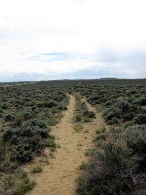
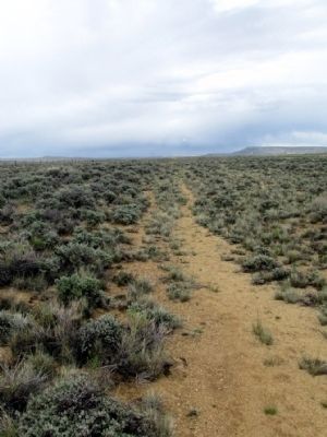
There, instead of following the regular Oregon Trail route southwest to Fort Bridger, then northwest to reach the Bear River below present day Cokeville, Wyoming, this wagon train pioneered a new route. Either Hitchcock or Greenwood, it is uncertain which, made the decision to lead the wagons due west, in effect along one side of a triangle.
The route was hazardous, entailing crossing some 50 miles of semi-arid desert in the heat of summer and surmounting mountain ridges, but it saved approximately 85 miles from the Fort Bridger route and 5 or 6 days of travel. The route was first known as the Greenwood Cut-off.
It was the Gold Rush year of 1849 that brought this "Parting of the Ways" into prominence. Of the estimated 30,000 Forty-niners probably 20,000 travelled the Greenwood Cut-off which, due to an error in the 1849 Joseph E. Ware guide book, became known as the Sublette Cut-off.
In the ensuing years further refinements of the Trail route were made. In 1852 the Kinney and Slate Creek Cut-offs diverted trains from portions of the Sublette Cut-off, but until the covered wagon period ended, the Sublette Cut-off remained a popular direct route, and this "Parting of the Ways" was the place for crucial decisions.
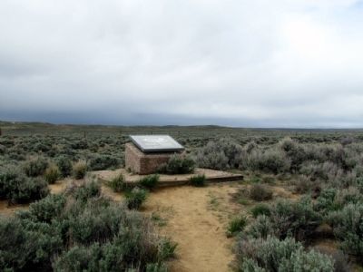
A quartzite post inscribed ←Fort Bridger S. Cut-off→ and a Bureau of Land Management information panel now mark the historic "Parting of the Ways" site.
Erected 1988 by Oregon-California Trails Association.
Topics and series. This historical marker is listed in these topic lists: Roads & Vehicles • Settlements & Settlers. In addition, it is included in the California Trail, the Mormon Pioneer Trail, and the Oregon Trail series lists. A significant historical month for this entry is July 1844.
Location. 42° 17.1′ N, 109° 3.55′ W. Marker is near Farson, Wyoming, in Sublette County. Marker can be reached from State Highway 28, 7 miles north of Sqaw Road (Route BLM4106). Marker is accessible from scenic pull-out on State Route 28. Touch for map. Marker is in this post office area: Lander WY 82520, United States of America. Touch for directions.
Other nearby markers. At least 8 other markers are within 6 miles of this marker, measured as the crow flies. A different marker also named "Parting of the Ways" (here, next to this marker); a different marker also named Parting of the Ways (within shouting distance of this marker); The Oregon Trail (about 300 feet away, measured in a direct line); Twin Mounds (approx. 5.4 miles away); The Way West (approx. 5.4 miles away); The Corridor West (approx. 5.4 miles away); The Fur Trade (approx. 5.4 miles away); South Pass (approx. 5.4 miles away). Touch for a list and map of all markers in Farson.
Credits. This page was last revised on December 2, 2021. It was originally submitted on July 26, 2013, by Duane Hall of Abilene, Texas. This page has been viewed 895 times since then and 30 times this year. Photos: 1, 2, 3, 4, 5. submitted on July 26, 2013, by Duane Hall of Abilene, Texas. • Syd Whittle was the editor who published this page.
