Los Lunas in Valencia County, New Mexico — The American Mountains (Southwest)
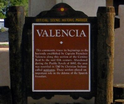
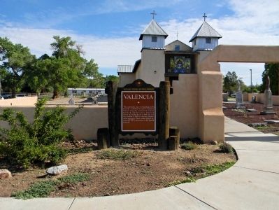
Valencia
Erected by New Mexico Historic Preservation Division.
Topics and series. This historical marker is listed in these topic lists: Native Americans • Settlements & Settlers. In addition, it is included in the El Camino Real de Tierra Adentro series list. A significant historical year for this entry is 1680.
Location. 34° 48.578′ N, 106° 42.003′ W. Marker is in Los Lunas, New Mexico, in Valencia County. Marker is at the intersection of Main Street NE (State Road 47) and Roberts Circle on Main Street NE. Touch for map. Marker is at or near this postal address: 5 Roberts Circle, Los Lunas NM 87031, United States of America. Touch for directions.
Other nearby markers. At least 8 other markers are within 11 miles of this marker, measured as the crow flies. Peralta (approx. 2 miles away); The Luna Mansion (approx. 2.1 miles away); Atchison, Topeka, and Santa Fe Railroad Depot (approx. 2.4 miles away); Vásquez de Coronado's Route (approx. 3.9 miles away); Tomé (approx. 5 miles away); Pueblo of Isleta (approx. 6½ miles away); Pueblo of Isleta Tuei (approx. 7 miles away); Los Padillas (approx. 10.2 miles away). Touch for a list and map of all markers in Los Lunas.
Also see . . . Valencia: A Spanish Colonial and Mexican-period site along NM 47 in Valencia County, New Mexico. (Submitted on July 27, 2013, by PaulwC3 of Northern, Virginia.)
Credits. This page was last revised on June 16, 2016. It was originally submitted on July 27, 2013, by PaulwC3 of Northern, Virginia. This page has been viewed 629 times since then and 17 times this year. Photos: 1, 2. submitted on July 27, 2013, by PaulwC3 of Northern, Virginia.

