Near Laclede in Linn County, Missouri — The American Midwest (Upper Plains)
[Covered Bridge] Truss Structures and Truss Variations
Inscription.
Truss Structures
Kingpost
The kingpost was the first and simplest truss structure used in America. Its basic idea consists of a center post, the kingpost, with compression beams slanting downward and outward toward each shore. The original kingpost design was somewhat limited in size due to the length of the compression beams.
Queenpost
The queenpost was adapted for building longer bridges. This truss design consists of an inverted "V" between two center posts and then compressed with beams slanting downward and outward toward each shore.
Warren Truss
The Warren truss was the first major variation in bridge design. This truss structure consisted of an "X" instead of a "V" in the middle of the queenpost truss resulting in a much stronger design.
All three, kingpost, queenpost, and Warren truss, were commonly used in building barns so they made an easy transition to covered bridges.
Truss Variations
Town Lattice Truss
In 1820, Ithiel Town obtained a patent for the lattice truss system. Besides adding strength, this system had the advantage of requiring shorter timbers. The design employed a large number of parallel diagonal timbers running in opposite directions. The resulting network supported covered bridges up to 220 feet in length.
Burr-Arch Truss
In 1817, Theodore Burr, later known as the "Father of the American Covered Bridge," patented the Burr-arch truss. This design increased the length and strength of the covered bridge. Burr simply added an arch to the vertical supports - a system once compared to "...a man who wears a belt but adds suspenders for additional support."
Howe Truss
In 1840, William Howe (uncle of Elias Howe who invented the sewing machine) patented the design that bears his name. The Howe truss was the first system to routinely employ both wood and wrought iron. The wrought iron rods were used as verticals while timbers continued to serve as diagonal braces. This design was very popular after 1850 and was strong enough to be adapted for railroad use.
The Building of a Bridge
There were two popular ways of constructing a covered bridge in the 1800s. With one method, the complete skeleton would be laid out upon the ground and fastened together loosely with wooden nails before raising the sections up and fastening them together. The other method, known as hoisting, involved placing each beam separately across the river starting with the bottom cord or cross beams and then working beam by beam to complete the truss structure.
Erected by Missouri
Dept of Natural Resources.
Topics and series. This historical marker is listed in these topic lists: Architecture • Bridges & Viaducts. In addition, it is included in the Covered Bridges series list. A significant historical year for this entry is 1820.
Location. 39° 47.519′ N, 93° 14.075′ W. Marker is near Laclede, Missouri, in Linn County. Marker is near the southwest end of the bridge, about one quarter mile from the parking lot at the east end of Dart Road. The parking lot is about 0.6 miles east of the intersection of Dart Road with Dauber Drive. Touch for map. Marker is in this post office area: Laclede MO 64651, United States of America. Touch for directions.
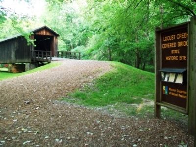
Other nearby markers. At least 8 other markers are within 4 miles of this marker, measured as the crow flies. Locust Creek Covered Bridge (here, next to this marker); Phil Kearny Post No. 19 G.A.R. Memorial (approx. 3.2 miles away); World War II Memorial (approx. 3.2 miles away); Laclede (approx. 3˝ miles away); John Joseph Pershing (approx. 3˝ miles away); General John J. Pershing Boyhood Home (approx. 3˝ miles away); a different marker also named Laclede (approx. 3˝ miles away); a different marker also named Laclede (approx. 3˝ miles away). Touch for a list and map of all markers in Laclede.
Also see . . . Locust Creek Covered Bridge State Historic Site. Missouri State Parks website entry (Submitted on July 31, 2013, by William Fischer, Jr. of Scranton, Pennsylvania.)
Credits. This page was last revised on March 11, 2024. It was originally submitted on July 31, 2013, by William Fischer, Jr. of Scranton, Pennsylvania. This page has been viewed 822 times since then and 42 times this year. Photos: 1, 2, 3, 4, 5, 6, 7, 8, 9, 10. submitted on July 31, 2013, by William Fischer, Jr. of Scranton, Pennsylvania.
![[Covered Bridge] Truss Structures and Truss Variations Marker. Click for full size. [Covered Bridge] Truss Structures and Truss Variations Marker image. Click for full size.](Photos2/248/Photo248951.jpg?731201330500PM)
![[Covered Bridge] Truss Structures and Truss Variations Marker - Kingpost. Click for full size. [Covered Bridge] Truss Structures and Truss Variations Marker - Kingpost image. Click for full size.](Photos2/248/Photo248952.jpg?731201330600PM)
![[Covered Bridge] Truss Structures and Truss Variations Marker - Queenpost. Click for full size. [Covered Bridge] Truss Structures and Truss Variations Marker - Queenpost image. Click for full size.](Photos2/248/Photo248953.jpg?731201330800PM)
![[Covered Bridge] Truss Structures and Truss Variations Marker - Warren Truss. Click for full size. [Covered Bridge] Truss Structures and Truss Variations Marker - Warren Truss image. Click for full size.](Photos2/248/Photo248956.jpg?731201331400PM)
![[Covered Bridge] Truss Structures and Truss Variations Marker - Town Lattice Truss. Click for full size. [Covered Bridge] Truss Structures and Truss Variations Marker - Town Lattice Truss image. Click for full size.](Photos2/248/Photo248957.jpg?731201331500PM)
![[Covered Bridge] Truss Structures and Truss Variations Marker - Burr-Arch Truss. Click for full size. [Covered Bridge] Truss Structures and Truss Variations Marker - Burr-Arch Truss image. Click for full size.](Photos2/248/Photo248962.jpg?731201332100PM)
![[Covered Bridge] Truss Structures and Truss Variations Marker - Howe Truss. Click for full size. [Covered Bridge] Truss Structures and Truss Variations Marker - Howe Truss image. Click for full size.](Photos2/248/Photo248971.jpg?731201333300PM)
![[Covered Bridge] Truss Structures and Truss Variations Marker - Building. Click for full size. [Covered Bridge] Truss Structures and Truss Variations Marker - Building image. Click for full size.](Photos2/248/Photo248974.jpg?731201333500PM)

