Sullivans Island in Charleston County, South Carolina — The American South (South Atlantic)
Victory at Breach Inlet
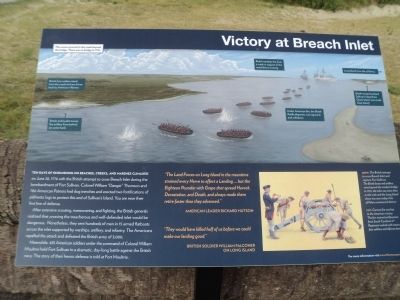
Ten days of skirmishing on beaches, creeks, and marshes climaxed on June 28, 1776 with the British attempt to cross Breach Inlet during the bombardment of Fort Sullivan. Colonel William “Danger” Thompson and 780 American Patriots had dug trenches and erected two fortifications of palmetto logs to protect this end of Sullivan’s Island. You are near their first line of defense.
After extensive scouting, maneuvering, and fighting, the British generals realized that crossing the treacherous and well-defended inlet would be dangerous. Nonetheless, they sent hundreds of men in 15 armed flatboats across the inlet supported by warships, artillery, and infantry. The Americans repelled the attack and defeated the British army of 3,000.
Meanwhile, 435 American soldiers under the command of Colonel William Moultrie held Fort Sullivan in a dramatic, day-long battle against the British navy. The story of their heroic defense is told at Fort Moultrie.
“The Land Forces on Long Island in the meantime strained every Nerve to effect a Landing . . . but the Eighteen Pounder with Grape shot spread Havock, Devastation, and Death, and always made then retire faster than they advanced.”
“They would have killed half of us before we could make our landing good.”
on Long Island
Topics. This historical marker is listed in this topic list: War, US Revolutionary. A significant historical month for this entry is June 1839.
Location. 32° 46.487′ N, 79° 48.868′ W. Marker is on Sullivans Island, South Carolina, in Charleston County. Marker is on Jasper Boulevard (State Highway 703), on the right when traveling east. Marker is located in Thomson Park. Touch for map. Marker is in this post office area: Sullivans Island SC 29482, United States of America. Touch for directions.
Other nearby markers. At least 8 other markers are within 2 miles of this marker, measured as the crow flies. Battle of Sullivan’s Island (here, next to this marker); Charles Town in the American Revolution (here, next to this marker); Liberty or Death (here, next to this marker); Thomson Park (here, next to this marker); Breach Inlet / Military History (a few steps from this marker); British Attack at Breach Inlet / Battery Marshall (a few steps from this marker); Lord Cornwallis (approx. 0.4 miles away); African American Cemetery (approx. 1˝ miles away). Touch for a list and map of all markers in Sullivans Island.
More about this marker. The background of the marker features a picture of the engagement, and contains the following captions:
This scene occurred in the creek beyond the bridge. There was no bridge in 1776.
British foot soldiers attack from the marsh and are driven back by American riflemen.
British and loyalist troops fire artillery from behind an oyster bank.
British warships fire from a creek in support of the amphibious crossing.
Under American fire, the British flotilla disperses, runs aground, and withdraws.
British troops bombard Sullivan’s Island from Green Island (now Little Goat Island).
Long Island (now Isle of Palms).
ABOVE: The British attempt to cross Breach Inlet and capture Fort Sullivan. The British boats and artillery were beyond the modern bridge. In 1776, the inlet was more than a mile wide and the Long Island shore was near today’s Isle of Palms commercial district.
The lower left of the marker contains a picture of an American artillery crew working at a cannon. It has a caption of “Left: Cannon fire was key to the American victory. The few trained artillerymen from South Carolina’s 4th Regiment worked with crews of foot soldiers and African slaves.”

Photographed By Bill Coughlin, August 3, 2013
3. Marker on Sullivans Island
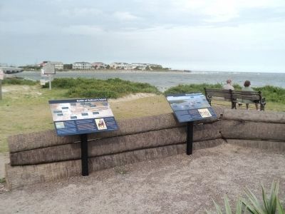
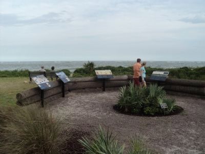
There are several markers at this location. The Victory at Breach Inlet marker can be seen here on the right.
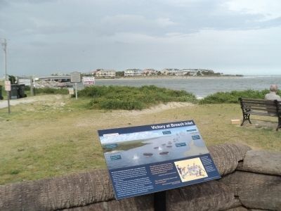
The land seen in the background is Isle of Palms (Long Island in 1776). It was from there that the British attempted to cross over to the American fortifications that were located at the site of the marker.
The land seen in the background is Isle of Palms (Long Island in 1776). It was from there that the British attempted to cross over to the American fortifications that were located at the site of the marker.
Credits. This page was last revised on November 2, 2020. It was originally submitted on August 3, 2013, by Bill Coughlin of Woodland Park, New Jersey. This page has been viewed 923 times since then and 39 times this year. Photos: 1, 2, 3, 4. submitted on August 3, 2013, by Bill Coughlin of Woodland Park, New Jersey.


