Abingdon in Washington County, Virginia — The American South (Mid-Atlantic)
Abingdon in the Civil War
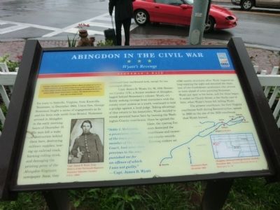
Wyatt's Revenge
— Stoneman's Raid —
On December 1, 1864, Union Gen. George Stoneman led 5,700 cavalrymen east from Knoxville, Tennessee, to destroy iron-, lead-, and saltworks in Virginia that were essential to the Confederate war effort. After actions at Kingsport and Bristol, Stoneman struck at Marion, Wytheville, and Austinville, then destroyed the saltworks at Saltville. Stoneman returned to Tennessee on January 1, 1865, having laid waste to every factory, railroad, depot, and warehouse in his path.
En route to Saltville, Virginia, from Knoxville, Tennessee, in December 1864, Union Gen. George Stoneman fought a series of engagements as he and his force rode north from Bristol. Stoneman arrived in Abingdon in the early morning hours of December 15. His men left a wake of destruction behind them here, destroying military supplies, tearing up railroad track, burning rolling stock, and damaging the printing press of the Abingdon-Virginian newspaper. Soon they continued their northward trek, except for one estranged officer.
Capt. James B. Wyatt, Co. M, 13th Tennessee Cavalry (US), a former resident of Abingdon, lagged behind Stoneman’s column. Wyatt, evidently seeking revenge from encounters with the county court system as a youth, continued to hold a grudge against a local judge. Taking advantage of this return to his hometown, Wyatt decided to wreak personal havoc here by burning the Washington County courthouse. Once ignited the blaze, the roaring fire soon destroyed the courthouse and numerous county records. Burning cinders set other structures afire. Wyatt lingered too long enjoying the sight and attracted the attention of two Confederate cavalrymen who arrived in town ahead of units pursuing Stoneman. Wyatt put spur to his horse and the chase began. It ended on Church Street a few blocks east of here, when Wyatt’s horse fell, killing Wyatt.
The present courthouse, the first Virginia Courthouse built during Reconstruction, opened in 1868 on the site of the 1850 courthouse that Wyatt burned.
“Noble I. McGinnis, a prominent citizen of the town and a member of the County Court, had some time previous to the war; punished me for an offence of which I was not guilty.” —Capt. James B. Wyatt.
(captions)
Capt. James B. Wyatt, from History of the Thirteenth Regiment Tennessee Volunteer Cavalry U.S.A. (1903)
Stoneman's Raid December 1864
Abingdon, showing buildings burned (shaded) December 1864 — Courtesy Historical Society of Washington Co., Va.
Erected by Virginia Civil War Trails.
Topics and series. This historical marker is listed in this topic list: War, US Civil. In addition, it is included in the Virginia Civil War Trails series list. A significant historical month for this entry is January 1849.
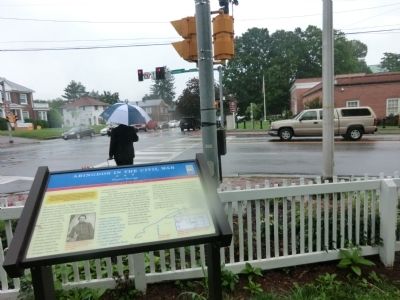
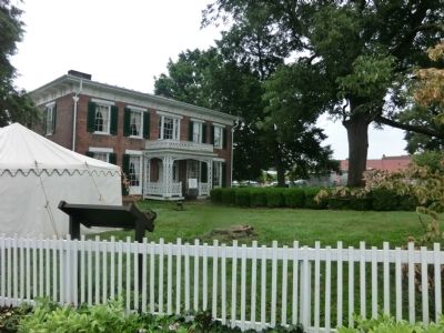
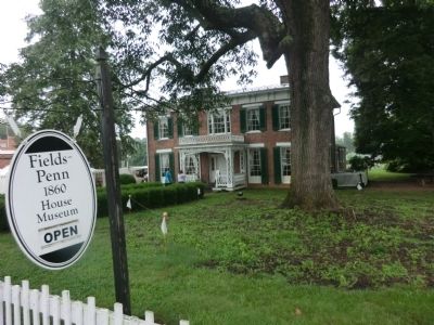
Location. 36° 42.576′ N, 81° 58.644′ W. Marker is in Abingdon, Virginia, in Washington County. Marker is at the intersection of West Main Street (U.S. 11) and Cummings Street SW (Alternate U.S. 58), on the right when traveling east on West Main Street. Marker is located in the northeast corner of the Fields-Penn 1860 House Museum property. Touch for map. Marker is at or near this postal address: 208 W Main St, Abingdon VA 24210, United States of America. Touch for directions.
Other nearby markers. At least 8 other markers are within walking distance of this marker. Boyhood Home of Gen. Joseph E. Johnston (within shouting distance of this marker); Abingdon (about 300 feet away, measured in a direct line); Martha Washington College (about 700 feet away); Barter Theatre (about 800 feet away); a different marker also named Barter Theatre (approx. 0.2 miles away); William Rodefer House (approx. 0.2 miles away); The Crooked Road / Abingdon (approx. 0.2 miles away); a different marker also named Barter Theatre (approx. 0.2 miles away). Touch for a list and map of all markers in Abingdon.
Credits. This page was last revised on February 2, 2023. It was originally submitted on August 4, 2013, by Don Morfe of Baltimore, Maryland. This page has been viewed 1,535 times since then and 88 times this year. Photos: 1, 2, 3, 4. submitted on August 4, 2013, by Don Morfe of Baltimore, Maryland. • Bernard Fisher was the editor who published this page.


