Gallatin in Daviess County, Missouri — The American Midwest (Upper Plains)
Gallatin
[Front]
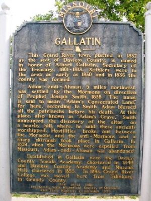
This Grand River town, platted in 1837 as the seat of Daviess County, is named in honor of Albert Gallatin, Secretary of the Treasury, 1801-1813. Settlers were in the area as early as 1830 and in 1836 the county was formed.
Adam-ondi-Ahman, 5 miles northwest was settled by the Mormons on direction of Prophet Joseph Smith, 1838. The name is said to mean "Adam's Consecrated Land," for here, according to Smith, Adam blessed all the patriarchs before his death. At this place, also known as "Adam's Grave," Smith announced the discovery of the altar, on a nearby hill, where, he said, these ancients worshipped. Hostilities broke out between the Mormons and the anti-Mormons and a sharp skirmish took place in Gallatin. In 1839, when the Mormons were expelled from Missouri, Adam-ondi-Ahman was abandoned.
Established in Gallatin were the Daviess County Female Academy, chartered in 1849, and Daviess County Academy and Masonic Hall, chartered in 1855. In 1893, Grand River College was moved here from Edinburg in Grundy County.
(See other side)
[Back]
(Continued from other side)
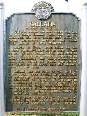
Gallatin, settled on land ceded the U.S. by the Osage Indians, 1808, and by the Sauk, Fox, and Iowa tribes, 1824, served a fertile agricultural area of the Green Hills Region of North Missouri.
Nearby is Grand River, called by the Indians Nischma-Honja and by early French writers Riviere Grande. This chief river of north Missouri has eroded a rock-walled valley paralleling the valley, a few miles east, which before the glacial age carried the Waters of the North, now the Missouri River, to the south.
Gallatin was the scene of the trial of Frank James, elder brother of Jesse, after he voluntarily surrendered to Gov. Thomas T. Crittenden on charges of participating in a holdup of a train near Winston to the southwest. The trial, 1882, highlighted by the appearance of Confederate Gen. Joseph O. Shelby as a defense witness, end in acquittal for Frank James.
Here lived A. M. Dockery, Governor of Missouri, 1901-1905, and Joshua W. Alexander, Secretary of Commerce of U.S., 1919-1921.
Erected 1953 by State Historical Society of Missouri and State Highway Commission.
Topics and series. This historical marker is listed in these topic lists: Churches & Religion • Native Americans • Settlements & Settlers • Waterways & Vessels. In addition, it is included in the Missouri, The State Historical Society of series list. A significant historical year for this entry is 1837.
Location. 39° 54.892′ N, 93° 57.697′ W. Marker is in Gallatin, Missouri, in Daviess County. Marker is on Main Street (Missouri Route 13) south of Jackson Street, on the right when traveling south. Marker is on the east grounds of the county courthouse. Touch for map. Marker is in this post office area: Gallatin MO 64640, United States of America. Touch for directions.
Other nearby markers. At least 8 other markers are within 12 miles of this marker, measured as the crow flies. Veterans Memorial (within shouting distance of this marker); Site of the 1883 Trial of Frank James (about 300 feet away, measured in a direct line); Site of the 1869 James Gang Bank Robbery (about 300 feet away); Harris Log House (approx. 9.4 miles away); Birthplace and Boyhood Home of Jerry Litton (approx. 10.9 miles away); Welcome to Hamilton (approx. 12 miles away); a different marker also named Welcome to Hamilton (approx. 12 miles away); Harden Stone Millstones (approx. 12 miles away). Touch for a list and map of all markers in Gallatin.
Also see . . . Gallatin History Museum. Museum website homepage (Submitted on May 15, 2022, by Larry Gertner of New York, New York.)
Credits. This page was last revised on May 15, 2022. It was originally submitted on August 5, 2013, by William Fischer, Jr. of Scranton, Pennsylvania. This page has been viewed 966 times since then and 68 times this year. Photos: 1, 2, 3. submitted on August 5, 2013, by William Fischer, Jr. of Scranton, Pennsylvania.


