Sullivans Island in Charleston County, South Carolina — The American South (South Atlantic)
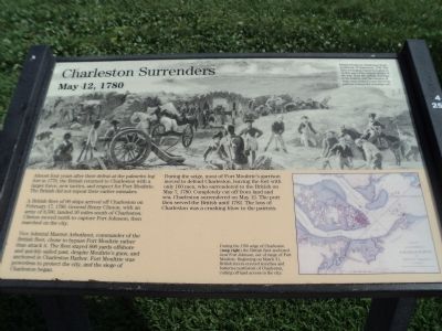
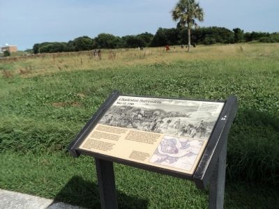
Charleston Surrenders
May 12, 1780
Almost four years after their defeat at the palmetto log fort in 1776, the British returned to Charleston with a larger force, new tactics, and respect for Fort Moultrie. The British did not repeat their earlier mistakes.
A British fleet of 96 ships arrived off Charleston on February 17, 1780. General Henry Clinton, with an army of 8,500, landed 30 miles south of Charleston. Clinton moved north to capture Fort Johnson, then marched on the city.
Vice Admiral Marriot Arbuthnot, commander of the British fleet, chose to bypass Fort Moultrie rather than attack it. The fleet stayed 800 yards offshore and quickly sailed past, despite Moultrie’s guns, and anchored in Charleston Harbor. Fort Moultrie was powerless to protect the city, and the siege of Charleston began.
During the siege, most of Fort Moultrie’s garrison moved to defend Charleston, leaving the fort with only 160 men, who surrendered to the British on May 7, 1780. Completely cut off by land and sea, Charleston surrendered on May 12. The port then served the British until 1782. The loss of Charleston was a crushing blow to the patriots.
Erected by National Park Service.
Topics. This historical marker is listed in this topic list: War, US Revolutionary. A significant historical month for this entry is February 1830.
Location. 32° 45.491′ N, 79° 51.463′ W. Marker is on Sullivans Island, South Carolina, in Charleston County. Marker can be reached from Poe Avenue, on the left when traveling west. Marker is located in front of Fort Moultrie. Touch for map. Marker is in this post office area: Sullivans Island SC 29482, United States of America. Touch for directions.
Other nearby markers. At least 8 other markers are within walking distance of this marker. British Attack (here, next to this marker); Palmetto Fort (here, next to this marker); Revolutionary War Artillery (a few steps from this marker); Fort Moultrie II (within shouting distance of this marker); 1860 Flanking Caponniere (within shouting distance of this marker); The Hunley Recovery Project (about 300 feet away, measured in a direct line); Discovering the Hunley (about 300 feet away); H.L. Hunley Disappears (about 300 feet away). Touch for a list and map of all markers in Sullivans Island.
More about this marker. A picture at the top of the marker includes the caption “British troops on Charleston Neck, northwest of Charleston, 1780. The force besieging Charleston grew to 14,000, one of the largest armies of the war. Note the British warships in the harbor, and the remains of ships sunk in the Cooper River by patriots to keep the warships out.
A map entitled “Plan of the Siege of Charleston in South Carolina” appears at the bottom right of the marker. It has a caption of “During the 1780 seige of Charleston (map right) the British fleet anchored near Fort Johnson, out of range of Fort Moultrie. Beginning on March 31, British forces erected trenches and batteries northwest of Charleston, cutting off land access to the city.”
Also see . . . Fort Moultrie. National Park Service website. (Submitted on August 7, 2013, by Bill Coughlin of Woodland Park, New Jersey.)
Credits. This page was last revised on June 16, 2016. It was originally submitted on August 7, 2013, by Bill Coughlin of Woodland Park, New Jersey. This page has been viewed 539 times since then and 28 times this year. Photos: 1, 2, 3. submitted on August 7, 2013, by Bill Coughlin of Woodland Park, New Jersey.


