Near Winnemucca in Humboldt County, Nevada — The American Mountains (Southwest)
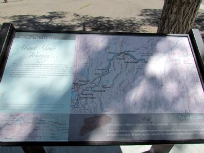
About Your Journey ...
The California Trail had its beginnings at several points along the Missouri River, and included several variant routes across the Great Basin and over the Sierra Nevada mountains into California. With the completion of the transcontinental railroad in 1869, most travelers made the journey by rail.
You're Invited!
There are many California Trail sites like this one, spread across Nevada. They're marked on this map.
As you stop at these sites, you'll learn more about what happened to these emigrants as they traveled across the Great Basin. Be sure to visit the California Trail Interpretive Center just west of Elko, Nevada.
Erected by Bureau of Land Management.
Topics and series. This historical marker is listed in these topic lists: Roads & Vehicles • Settlements & Settlers. In addition, it is included in the California Trail series list. A significant historical year for this entry is 1869.
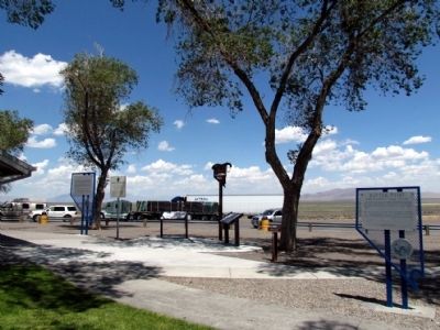
Location. 41° 0.996′ N, 117° 34.408′ W. Marker is near Winnemucca, Nevada, in Humboldt County. Marker can be reached from Interstate 80 at milepost 187, on the right when traveling west. Marker is located at the Button Point Rest Area; the rest area is accessible from both eastbound and westbound travel lanes at Exit 187. Touch for map. Marker is in this post office area: Winnemucca NV 89445, United States of America. Touch for directions.
Other nearby markers. At least 8 other markers are within 9 miles of this marker, measured as the crow flies. International Intrigue and the Humboldt River (here, next to this marker); California Trail - Humboldt Sloughs (here, next to this marker); Button Point (here, next to this marker); Humboldt River (here, next to this marker); Golconda (approx. 6˝ miles away); The Humboldt Canal (approx. 8.3 miles away); Veterans Memorial Park (approx. 8.8 miles away); Winnemucca World War I American Legion Honor Roll (approx. 8.9 miles away). Touch for a list and map of all markers in Winnemucca.
Also see . . . California Trail Interpretive Center Website. (Submitted on August 8, 2013, by Duane Hall of Abilene, Texas.)
Credits. This page was last revised on June 16, 2016. It was originally submitted on August 8, 2013, by Duane Hall of Abilene, Texas. This page has been viewed 428 times since then and 11 times this year. Photos: 1, 2. submitted on August 8, 2013, by Duane Hall of Abilene, Texas.

