Near Elko in Elko County, Nevada — The American Mountains (Southwest)
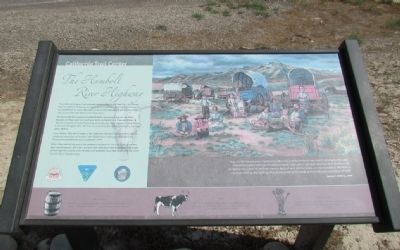
The Humboldt River Highway
The Humboldt River begins at Humboldt Wells, springs near present-day Wells, Nevada, and flows west and southwest to the Humboldt Sink. It generally took 16 days for emigrants to make the journey along the river. Most travelers crossed Nevada in the heat of August, when the trail was very dusty, the river was nearly dry, and the water alkaline.
From 1849 to 1853, at the height of the California Gold Rush, approximately 200,000 emigrants passed by this location, with 50,000 more making the trek before the Transcontinental Railroad was completed in 1869.
When they reached this point, the emigrants had been on the trail for three months, had traveled about 1,600 miles, and were 400 miles from their destination. Still ahead of them lay the crossing of the dreaded and waterless Forty-Mile Desert and the climb over the Sierra Nevada Range.
(Drawing Caption)
"Aug. 25. We hunted down the River 3 miles more and found but a very scanty picking for the oxen. Everybody hungry and out of humor as usual. From what I can hear and I speak to almost every company I see, I don't think there is ever a body of men left the states, on any expedition, that had so much quarrelling and fighting, (the strong abusing the weak) as the California expedition of 1849."
James F. Wilkins, 1849
Erected by Bureau of Land Management.
Topics and series. This historical marker is listed in these topic lists: Roads & Vehicles • Settlements & Settlers. In addition, it is included in the California Trail series list. A significant historical year for this entry is 1849.
Location. 40° 46.024′ N, 115° 55.356′ W. Marker is near Elko, Nevada, in Elko County. Marker can be reached from Interstate 80 at milepost 292, on the right when traveling west. To visit the marker, exit I-80 at Exit 292 (Hunter) and follow the directional signs to the California Emigrant Trail Interpretive Center; the marker is at the gated entrance to the Center. Touch for map. Marker is in this post office area: Elko NV 89801, United States of America. Touch for directions.
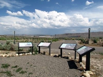
Other nearby markers. At least 8 other markers are within 6 miles of this marker, measured as the crow flies. About Your Journey ... (here, next to this marker); The California Emigrant Trail Interpretive Center (here, next to this marker); The End of the Hastings Cutoff (here, next to this marker); Marking Time (a few
steps from this marker); California Trail - Greenhorn Cutoff (a few steps from this marker); West End of Hastings Cutoff (approx. 0.2 miles away); Hoppe-Lienhard Wagon Group (approx. 0.2 miles away); California Trail - Carlin Canyon (approx. 5.3 miles away). Touch for a list and map of all markers in Elko.
Also see . . . California Trail Interpretive Center Website. (Submitted on August 10, 2013, by Duane Hall of Abilene, Texas.)
Credits. This page was last revised on June 16, 2016. It was originally submitted on August 10, 2013, by Duane Hall of Abilene, Texas. This page has been viewed 573 times since then and 33 times this year. Photos: 1, 2. submitted on August 10, 2013, by Duane Hall of Abilene, Texas.

