Luzern, Switzerland — Central Europe (the Alps)
Mühlenplatz (Mill Place)
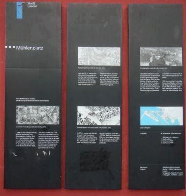
Von Mühlerad zur Turbine (From Mill Wheel to Turbine).
— Die Nutzung der Wasserkraft am Mühlenplatz (The Use of Water Power on Mühlenplatz). —
Photographed By Barry Swackhamer, July 4, 2013
1. Mühlenplatz (Mill Place) Marker, panel 1
Captions:
Luzerner Chronik des Diebold Schilling 1513 (Lucerne Chronicle of Diebold Schilling 1513), Stadtprospekt von Martin Martini, 1597 (Bird’s-eye-view drawing by Martin Martini 1597), Stadtprospekt von Franz Xaver Schumacher, 1792 (Bird’s-eye-view drawing by Franz Xaver Schumacher 1792), Photographic nach dem Brand von 1932 (Photographic after the fire of 1932),
Ünbersichtsplan (Site map)
Legende (Legend):
Allgemeine Informationen (General Information)
Weitere Informationen
Legende (Legend):
1 Stadtmühlen (City mills)
2 Kraftwerk 1887(Power plant in 1887)
Von Mühlerad zur Turbine
Die Nutzung der Wasserkraft am Mühlenplatz
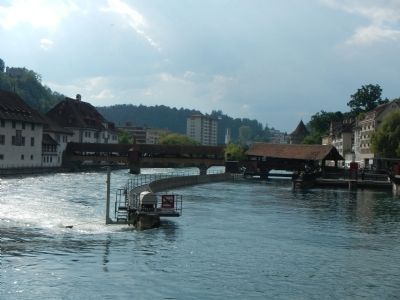
Lange vor der Stadtgründung wird die Wasserkraft der Reuss genutzt. Das seit dem 8. Jh. nachweisbare Kloster im Hof betreibt hier seine Mühlen. Nach der Mitte des 14. Jn. Gelangen die Mühlen unter die Kontrolle der Stadt. Das Bild aus dem Jahr 1513 zeigt den Schiffbruch von Luzerner Kaufleuten an der im Flussbett verankerten Schwelle. Diese staut das Wasser und leitet es dem Mühlard zu. Die einfache, aus Holz gebaute Mühle steht oberhalb der Spreuerbrücke im Fluss.
Ende des 16. Jh. stehen drei hölzerne Mühlengebäude am Ufer und auf künstlich geschaffenen Inseln in der Reuss. Jede Mühle verfügt über mehrere Wasserräder. Diese treiben nicht nur Getreidemühlen, sondern auch stampf-und Schleifwerke an. Die Kraftübertragung erfolgt über hölzerne Übersetzungsgetriebe. Der Mühlenplatz dient als Werk und Umschlagplatz.
Im 17. Jh. werden die Mühlen erneuert und ausgebaut. Fünf Kanäle leiten das Wasser auf insgesamt zehn Wasserräder. Ein sechster, unterirdischer Kanal speist die städtische Münzstätte, in der von 1597 bis 1846 mit Wasserkraft Münzen geschlagen werden. Ein Grossbrand zerstört 1875 die drei nördlichen Mühlengebäude.
1887/89 erstellt die Korporationsgemeinde ein Kraftwerk und ein Gewerbegebäude über der Reuss. Über hundert Meister, Arbeiter und Lehrlinge finden hier ihr Auskommen. Drei Jonvalturbinen erzeugen die notwendige Energie. Die mechanische Kraftübertragung mit Transmissionswellen wird 1926 durch einen Drehstromgenerator abgelöst.
1933 vernichtet ein Brand das Gewerbegebäude, welches in der Folge abgebrochen wird. Das Kraftwerk bleibt bestehen und liefert noch bis 1977 Strom an das städtische Netz.
German-English translation:
From Mill Wheel to Turbine.
The Use of Water Power at Mill Square
The water power of the Reuss was harnessed long before the founding of the city. The Monastery in Hof (known since the 8th Century) operated mills here. After the mid-14th century the mills here came under the control of the city. The picture from the 1513 shows the boat channel used by Lucerne merchants to navigate the weir, which was anchored to the river bed. This built up water and directed it to the mill works. A simple wooden mill stands in the river upstream from Mill Bridge.
By the end of the 16th Century, three wooden mill buildings stood here on the banks of artificially-created islands. Each mill housed several water wheels. These powered not only grain mills, but also hammer- and grist mills, with the power transmitted through wooden gears. The mills served as both work spaces and transshipment points.
In the 17th Century the mills were rebuilt and expanded. Five channels directed the water to a total of ten water wheels. A sixth, underground channel fed the municipal mint, whose coins were struck from 1597-1846 using hydropower. In 1875, a large fire destroyed the three northern mill buildings.
In 1887-89 the municipality constructed a power plant and workspace on the River Reuss. About a hundred masters, workers and apprentices made a living here, with three Jonval turbines producing the necessary energy. In 1926 the mechanical power transmission shafts were superseded by an AC generator.
In 1933 a fire gutted the workspace, which was consequently demolished. The power plant remained and provided power to the municipal grid until 1977.
Panel 2
Stadtmuhlen
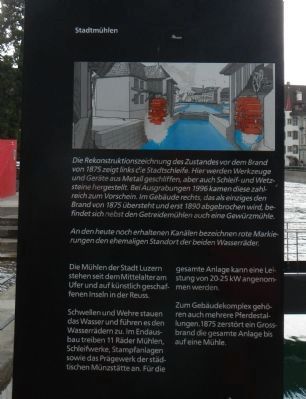
Die Rekonstruktionszeichnung des Zustandes vor dem Brand von 1875 zeigt links die Stadtschleife. Heir werden Werkzeuge und Geräte aus Metall geschliffen, aber auch Schleif-und Wetzsteine hergestellt. Bei Ausgrabungen 1996 kamen diese zahlreich zum Vorschein. Im Gebäude rechts, das als einziges den Brand von 1875 übersteht und erst 1890 abgebrochen wird, befindet sich nebst den Getreidemühlen auch eine Gewürzmuhle.
An den heute noch erhalttenen Kanälen bezeichnen rote Markierungen den ehemaligen Standort der beiden Wasserräder.
Die Mühlen der Stadt Luzern stehen seit Mittelalter am Ufer und auf künstlich geschaffenen Inseln in der Reuss.
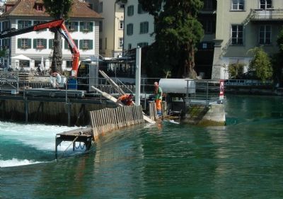
Schwellen und Wehre stauen das Wasser und führen es den Wasserädem zu. Im Endausbau treiben 11 Räder Mühlen, Schleifwerke, Stampfanlagen sowie das Prägewerk der städtischen Münzstätte an. Für die gesamte Anlage kann eine Leistung von 20-25 kW angenommen werden.
Zum Gebäudekomplex gehören auch mehrere Pferdestallungen. 1875 zerstört ein Grossbrand die gesamte Anlage bis auf eine Mühle.
German-English translation:
The City Mills
This drawing depicts an artist's rendering of the municipal metal works, as before before the fire of 1875. These works produced not only metal tools and equipment, but also made grinding- and whet stones, as numerous finds from a 1996 excavation have revealed. The building on the right, next to the flour- and spice mills, was the sole survivor of the 1875 fire, and was demolished in 1890.
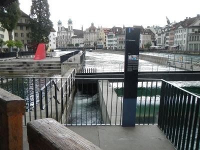
The former location of two water wheels is denoted by red markings on the channels, still preserved to this day.
The mills of the city of Lucerne have stood here on the shore and on artificially created islands since the Middle Ages.
Thresholds and weirs controlled the water and carried it to the water wheels. In its final configuration, 11 wheels were providing power to mills, grinding- and stamping plants, as well as the city mint, with a presumptive power of 20-25 kW for the entire system. The building complex also included several horse stables. In 1875 a fire destroyed the works, but for a single mill.
Panel 3
Das Kraftwerk von 1887/89
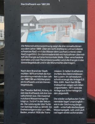
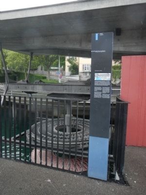
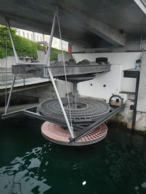
Die Rekonstruktionszeichnung zeigt die drei Jonvalturbinen aus dem Jahre 1889. Über ein nicht drehbares Leitrad (oberes schwarzes Rad) wird das Wasser dem Laufrad (unteres rotes Rad) zugeführt. Ein Kammradantrieb mit Holzzähnen übermittelt die Energie auf eine horizontale Welle. Über verschiedene Getriebe und zwei Transmissionswellen wird die Energie in das Gewerbegebaude und in die Munzhühle übertragen.
Nach dem Brand der Stadtmühlen 1875 errichtet die Korporationsgemeinde in den Jahren 1887/89 am Mühlenplatz ein Kraftwerk und ein Gewerbegebäude.
Die Theodor Bell AG, Kriens, rüstet das Kraftwerk mit drei Jonvalturbinen aus. Die maximal nutzbare Wassermenge beträgt ca. 3 x 6 m3 in der Sekunde. Die Leistung der drei Turbinen beträgt total ca. 60 kW. Ein Drehstromgenerator von BBC, Baden, ersetzt 1926 die Transmission. Er liefert Kraftstrom ins Netz des Elektrizitätswerkes Luzern. Im Jahresdurchschnitt erzeugt die Anlage 0,5 Mio. kWh. Nach fast 90 Betriebsjahren zeigen sick Alterungsschäden. 1977 wird die Anlage aus Sicherheitsgrunden abgestellt.
Die wieder aufgebauten Turbinenräder lagen ursprünglich – wie in der Zeichnung dargestellt – unterhalb des heutigen Wasserspiegels. Leit-und Laufrad lagen direkt aufeinander.
German-English translation:
The Power Plant of 1887-89
This artist's reconstruction shows the three Jonval turbines from 1889. A non-rotatable stator (upper black wheel) conducted the water to the impeller (lower red wheel). A cam-driven gear with wooden teeth transmitted the energy through a horizontal shaft. Through various transmitting gears and shafts, the energy was transferred to the workshop and the mint.
After the fire of 1875 destroyed the city's mills, the municipality erected a power plant and workshop on the site.
The power plant was equipped with three Jonval turbines by Theodore Bell AG of Kriens. The maximum usable amount of water is approximately 3 x 6 cubic meter per second. The total power generated by the three turbines is about 60 kW. In 1926, an AC generator by BBC of Baden, replaced the transmission. It supplied power to the Lucerne municpal grid, providing an average of 0.5 million kWh annually. After nearly 90 years of operation the wear and tear on the plant began to show, and in 1977 the plant was shut down for safety reasons.
The reconstructed turbine wheels were originally - as shown in the drawing - below the present water level. The master wheel was directly on top of the running wheel.
Erected by Stadt der Luzern (City of Lucerne).
Topics. This historical marker is listed in these topic lists: Industry & Commerce • Waterways & Vessels. A significant historical year for this entry is 1513.
Location. 47° 3.12′ N, 8° 18.151′ E. Marker is in Luzern. Marker is at the intersection of Spreuerbrücke and Mühlenplatz, on the left when traveling west on Spreuerbrücke. Touch for map. Marker is at or near this postal address: Spreuerbrücke, Luzern 6004, Switzerland. Touch for directions.
Other nearby markers. At least 8 other markers are within walking distance of this marker. The Spreuer Bridge Paintings (a few steps from this marker); Louis Pfyffer von Wyher (within shouting distance of this marker); The Mills Gate (within shouting distance of this marker); Dr. Jur. Kasimir Pfyffer (within shouting distance of this marker); The Old Armory (about 90 meters away, measured in a direct line); The Spreuer Bridge (about 90 meters away); Lower- or Basel-Gate (about 120 meters away); The Sonnenberg House in Zoepfli (about 120 meters away). Touch for a list and map of all markers in Luzern.
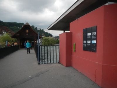
More about this marker. The Mühlenplatz marker is composed of three separate panels, located at the western end of Spreuer Bridge.
Credits. This page was last revised on June 16, 2016. It was originally submitted on August 12, 2013, by Barry Swackhamer of Brentwood, California. This page has been viewed 859 times since then and 30 times this year. Photos: 1, 2, 3, 4, 5, 6, 7, 8, 9. submitted on August 12, 2013, by Barry Swackhamer of Brentwood, California. • Andrew Ruppenstein was the editor who published this page.
