West Ashley in Charleston in Charleston County, South Carolina — The American South (South Atlantic)
A Temporary Home?
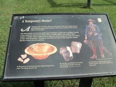
A building of the 1670-80 settlement once stood at this spot. Its discovery by archaeologists raised many questions. What was its purpose? Who used it? What did I look like?
One interpretation, based on the artifact types found here, is that it was a dwelling. Possibly it was occupied by indentured servants, slaves or militia soldiers. The relatively large number of military artifacts suggests that it might have been a temporary shelter for soldiers on duty within the palisade. The pottery, wine bottles and tobacco pipe fragments indicate that they cooked, ate and rested here.
Topics. This historical marker is listed in these topic lists: Colonial Era • Settlements & Settlers.
Location. 32° 48.184′ N, 79° 59.086′ W. Marker is in Charleston, South Carolina, in Charleston County. It is in West Ashley. Marker can be reached from Old Town Plantation Road. Marker is located on the History Trail at Charles Towne Landing. Touch for map. Marker is at or near this postal address: 1500 Old Towne Road, Charleston SC 29407, United States of America. Touch for directions.
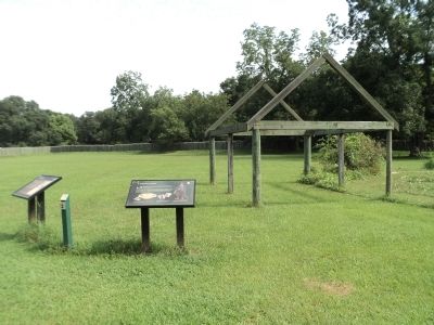
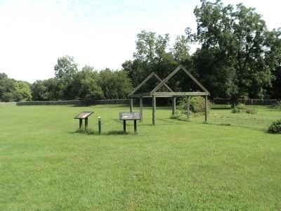
Other nearby markers. At least 8 other markers are within walking distance of this marker. Ghost Structure (here, next to this marker); Buildings “All of Wood”? (a few steps from this marker); Seeking Wealth, Sowing Servitude (within shouting distance of this marker); Stained Dirt?! (within shouting distance of this marker); The Search Goes On (about 300 feet away, measured in a direct line); In Trust (about 300 feet away); Protecting the Colony – The Palisade Wall (about 300 feet away); 300th Anniversary of the Settlement of Charles Towne (about 400 feet away). Touch for a list and map of all markers in Charleston.
More about this marker. Three pictures appear at the bottom of the marker. On the left is a picture of a bowl with a caption of “The presence of North Devon pottery helped identify this as a late 17th-century domestic site.” Next to this is a picture of gun flints and the caption “Gun flints, possibly from the settlers’ French firelock muskets, were also found nearby.” A picture of a soldier, illustration courtesy of Osprey Publishing, Ltd., is on the right side of the marker, and includes the caption “The building might have been used by soldiers similar to this civilian militia man of the 1670s.”
Credits. This page was last revised on February 16, 2023. It was originally submitted on August 20, 2013, by Bill Coughlin of Woodland Park, New Jersey. This page has been viewed 491 times since then and 8 times this year. Photos: 1, 2, 3, 4. submitted on August 20, 2013, by Bill Coughlin of Woodland Park, New Jersey.


