West Ashley in Charleston in Charleston County, South Carolina — The American South (South Atlantic)
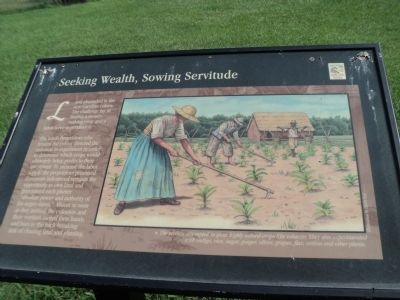
Seeking Wealth, Sowing Servitude
Land abounded in the new Carolina colony. The challenge lay in finding a money-making crop and a labor force to produce it.
The Lords Proprietors who funded the colony directed the colonists to experiment in order to determine which crops would ultimately bring profits to their investment. To increase the labor supply, the proprietors promised European indentured servants the opportunity to own land and guaranteed each planter “absolute power and authority of his negro slaves.” Almost as soon as they arrived, the colonists and their workers turned their hands and hoes to the back-breaking task of clearing land and planting.
Topics. This historical marker is listed in these topic lists: Colonial Era • Settlements & Settlers.
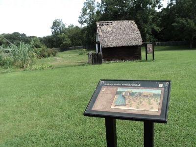
Location. 32° 48.174′ N, 79° 59.072′ W. Marker is in Charleston, South Carolina, in Charleston County. It is in West Ashley. Marker can be reached from Old Town Plantation Road. Marker is located on the History Trail at Charles Towne Landing. Touch for map. Marker is at or near this postal address: 1500 Old Towne Road, Charleston SC 29407, United States of America. Touch for directions.
Other nearby markers. At least 8 other markers are within walking distance of this marker. Buildings “All of Wood”? (a few steps from this marker); A Temporary Home? (within shouting distance of this marker); Ghost Structure (within shouting distance of this marker); Stained Dirt?! (within shouting distance of this marker); Protecting the Colony – The Palisade Wall (about 300 feet away, measured in a direct line); The Search Goes On (about 300 feet away); In Trust (about 400 feet away); Mixed Results (about 500 feet away). Touch for a list and map of all markers in Charleston.
More about this marker. The right side of the marker features a picture, illustration by Darby Erd, of colonists working in the fields. It has a caption of “The settlers attempted to grow highly valued crops like tobacco. They also experimented with indigo, rice, sugar, ginger, olives, grapes, flax, cotton and other plants.”
Credits. This page was last revised on February 16, 2023. It was originally submitted on August 20, 2013, by Bill Coughlin of Woodland Park, New Jersey. This page has been viewed 440 times since then and 12 times this year. Photos: 1, 2, 3, 4. submitted on August 20, 2013, by Bill Coughlin of Woodland Park, New Jersey.


