Near Wytheville in Wythe County, Virginia — The American South (Mid-Atlantic)
Toland’s Raid
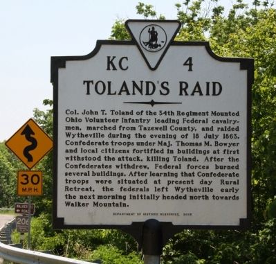
Col. John T. Toland of the 34th Regiment Mounted Ohio Volunteer Infantry leading Federal cavalrymen, marched from Tazewell County, and raided Wytheville during the evening of 18 July 1863. Confederate troops under Maj. Thomas M. Bowyer and local citizens fortified in buildings at first withstood the attack, killing Toland. After the Confederates withdrew, Federal forces burned several buildings. After learning that Confederate troops were situated at present day Rural Retreat, the federals left Wytheville early the next morning initially headed north towards Walker Mountain.
Erected 2005 by Department of Historic Resources. (Marker Number KC-4.)
Topics and series. This historical marker is listed in this topic list: War, US Civil. In addition, it is included in the Virginia Department of Historic Resources (DHR) series list. A significant historical date for this entry is July 18, 1863.
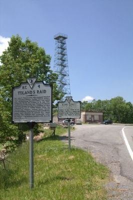
Location. 37° 2.74′ N, 81° 13.642′ W. Marker is near Wytheville, Virginia, in Wythe County. Marker is at the intersection of Stony Fork Road / South Scenic Highway (U.S. 52) and Old Mountain Road (County Route 621), on the right when traveling south on Stony Fork Road / South Scenic Highway. Marker is at Big Walker Mountain Lookout. Touch for map. Marker is at or near this postal address: 8711 Stony Fork Rd, Wytheville VA 24382, United States of America. Touch for directions.
Other nearby markers. At least 8 other markers are within 7 miles of this marker, measured as the crow flies. Wythe County / Bland County (a few steps from this marker); Battle of Wytheville (within shouting distance of this marker); One of the “Big Four” (approx. 2.2 miles away); a different marker also named Battle of Wytheville (approx. 3.2 miles away); Homesteader's Legacy (approx. 5 miles away); a different marker also named Battle of Wytheville (approx. 6.1 miles away); Henry C. Groseclose (approx. 6.7 miles away); Bland (approx. 6.9 miles away). Touch for a list and map of all markers in Wytheville.
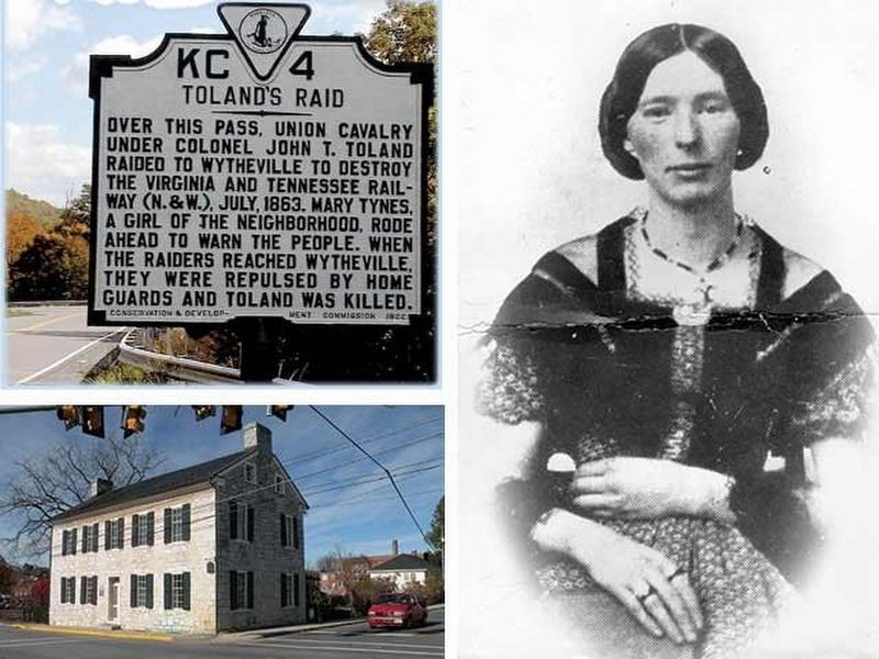
More about this marker. This marker replaced a 1932 marker with the same title and number that read, “Over this pass, Union cavalry under Colonel John T. Toland raided to Wytheville to destroy the Virginia and Tennessee railway (N.& W.), July, 1863. Mary Tynes, a girl of the neighborhood, rode ahead to warn the people. When the raiders reached Wytheville, they were repulsed by the Home Guards and Toland was killed.”
Also see . . . Did Molly Ride? 'Confederate Paul Revere' Lives on in Southwest Virginia. Blue Ridge Country website entry:
Unlike the original marker, the new one makes no mention of Molly Tynes. Her story is on this link. “As the legend goes, Molly learned about the Union plans and decided to
risk a harrowing ride across several mountain ranges to warn Wytheville’s townspeople of the Yankee approach.
So it was Molly left home late in the afternoon on July 17, 1863, on her mare, ‘Fashion,’ rode more than 40 miles over mountain ranges, through historic Burke’s Garden and finally across Big Walker Mountain, and arrived in Wytheville at about dawn the next day, July 18, to exclaim, ‘Yankees are coming’.” (Submitted on July 4, 2011.)
Credits. This page was last revised on February 23, 2022. It was originally submitted on July 3, 2011, by J. J. Prats of Powell, Ohio. This page has been viewed 1,476 times since then and 66 times this year. Last updated on August 22, 2013, by Linda Walcroft of Woodstock, Virginia. Photos: 1. submitted on July 3, 2011, by J. J. Prats of Powell, Ohio. 2. submitted on July 4, 2011, by J. J. Prats of Powell, Ohio. 3. submitted on February 23, 2022, by Larry Gertner of New York, New York. • Bill Pfingsten was the editor who published this page.


