Tubac in Santa Cruz County, Arizona — The American Mountains (Southwest)
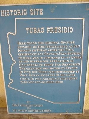
Tubac Presidio
Inscription.
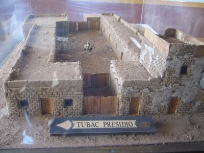
Here stood the original Spanish presidio or fort established as San Ignacio de Tubac after the Pima uprising of 1751. Captain Juan Bautista de Anza was in command in 1775, when he led his famous expedition to California to found San Francisco. The garrison was moved to Tucson in 1776, but Tubac was reoccupied by Pima Indian soldiers in the later 1780's. In 1959 Arizona's first state park was established here.
Erected by Tubac Historical Society and the Arizona Historical Society.
Topics and series. This historical marker is listed in these topic lists: Forts and Castles • Notable Places • Settlements & Settlers. In addition, it is included in the Juan Bautista de Anza National Historic Trail series list. A significant historical year for this entry is 1751.
Location. 31° 36.725′ N, 111° 2.787′ W. Marker is in Tubac, Arizona, in Santa Cruz County. Touch for map. Marker is in this post office area: Tubac AZ 85646, United States of America. Touch for directions.
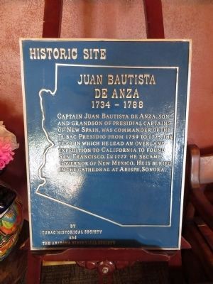
Other nearby markers. At least 8 other markers are within 3 miles of this marker, measured as the crow flies. Tubac Schools (within shouting distance of this marker); Presidio of Tubac (within shouting distance of this marker); Churches in Tubac (within shouting distance of this marker); Juan Bautista de Anza (about 300 feet away, measured in a direct line); Baca Float Number 3 (about 300 feet away); Charles Debrille Poston (about 400 feet away); Tubac (approx. 0.3 miles away); Mission San José de Tumacácori (approx. 3.1 miles away). Touch for a list and map of all markers in Tubac.
More about this marker. Marker is in storage at the Tubac Presidio Historic State Park.
Regarding Tubac Presidio. Tubac Presidio State Historic Park is now operated by the Friends of the Tubac Presidio Park and Museum. The park is open 7 days a week from 9 am - 5 pm.
Credits. This page was last revised on June 16, 2016. It was originally submitted on February 3, 2010, by Bill Kirchner of Tucson, Arizona. This page has been viewed 1,406 times since then and 40 times this year. Last updated on August 23, 2013, by Bill Kirchner of Tucson, Arizona. Photos: 1, 2. submitted on February 3, 2010, by Bill Kirchner of Tucson, Arizona. 3. submitted on August 23, 2013, by Bill Kirchner of Tucson, Arizona. • Syd Whittle was the editor who published this page.


