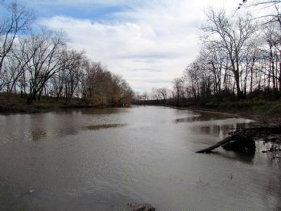
Near Lagro in Wabash County, Indiana — The American Midwest (Great Lakes)
The Wabash River
History of the River
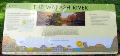
The Wabash Valley drained thousands of square miles of the Wisconsin glacier during the latter part of the Ice Age, acting as the primary sluiceway for unimaginably large amounts of glacial meltwater that would dwarf the modern river modern times over. Vast amounts of glacial outwash composed of coarse sand and gravel were deposited in the sluiceway, eventually filling it from rim to rim. The event most directly responsible for the form and size of the modern valley is the Maumee Torrent, the catastrophic outburst of Glacial Lake Maumee at the close of glaciation, which probably filled the valley from wall to wall with frigid, rushing meltwater. Although it only lasted a few weeks, the Maumee Torrent was so powerful that it stripped away most of the glacial outwash and eroded the valley floor into the Silurian bedrock we see today. As a result, this reach of the Wabash River is an underfit stream – meaning that the river appears much too small to have eroded the massive valley it flows in.
The Wabash River & Glacier Tributaries
outline the position of the Erie Lobe during the last glaciation
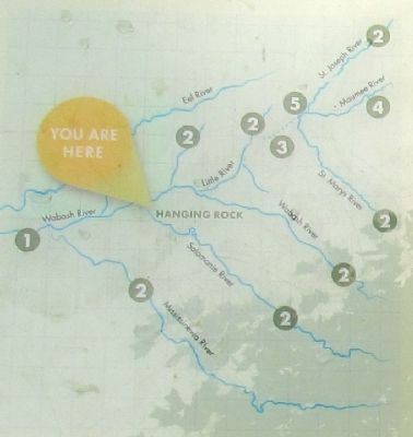
1. The Wabash River follows the former axis of the Erie Lobe Glacier
2. Major tributaries occupy margins of the last glacial retreat
3. Post-glacial watershed initially included St. Joseph and St. Mary's Rivers, as shown by the dashed blue line
4. Drainage through the St. Lawrence Seaway and eastern Great Lakes developed and led to the capture of the St. Joseph and St. Mary's by the Maumee River
5. Strategically important "Three Rivers" confluence was formed, later becoming Fort Wayne, establishing the eastern continental drainage divide
Fun Facts
• Called Wah-Bah Shik-Ki by Miami Indians, meaning "water over white stones" due to the limestone river bottom
• 475 miles long
• Longest free-flowing river east of the Mississippi River
• Drains 73 of Indiana's 92 counties
• Home to nearly 400 species of wildlife
• Created by the Maumee Torrent 14,000 years ago
Erected by ACRES Land Trust.
Topics. This historical marker is listed in this topic list: Natural Features.
Location. 40° 49.808′ N, 85° 42.442′ W. Marker is near Lagro, Indiana, in Wabash County. Marker can be reached from E. Hanging Rock Road, 0.8 miles east of State Road 524, on the left when traveling east. Touch for map. Marker is in this post office area: Lagro IN 46941, United States of America. Touch for directions.
Other nearby markers. At least 8 other markers are within 6 miles of this marker, measured as the crow flies. Hanging Rock (a few steps from this marker); Kerr Lock (approx. 1.1 miles away); St. Patrick's Roman Catholic Church (approx. 1.3 miles away); Dallas Township World War II Roll of Honor (approx. 5.9 miles away); Hanna Park (approx. 5.9 miles away); The Wabash River and the Big Four Cut (approx. 6.1 miles away); Kin-Com-A-Ong Spring (approx. 6.1 miles away); Cleveland, Cincinnati, Chicago & St. Louis Railway (approx. 6.1 miles away). Touch for a list and map of all markers in Lagro.
Credits. This page was last revised on June 16, 2016. It was originally submitted on August 25, 2013, by Duane Hall of Abilene, Texas. This page has been viewed 840 times since then and 31 times this year. Photos: 1, 2, 3, 4, 5. submitted on August 25, 2013, by Duane Hall of Abilene, Texas.
