St. Joseph in Berrien County, Michigan — The American Midwest (Great Lakes)
Creating a Harbor
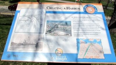
In the 1830s, at the urging of local merchants, the U.S. Corps of Engineers removed a large sandbar and built protective piers on either side of the river mouth. By 1838, the swampy river entrance was transformed into a thriving port, rivaling the maritime trade of Chicago.
Regular dredging, pier maintenance and lighthouses keep the harbor accessible for commercial and recreational traffic.
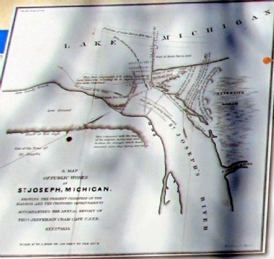
(Upper Drawing Caption)
Making a harbor from the narrow river mouth required extensive engineering. This 1839 drawing proposes the extension of piers, changing the river's course and depth.
MAP: The Heritage Museum and Cultural Center
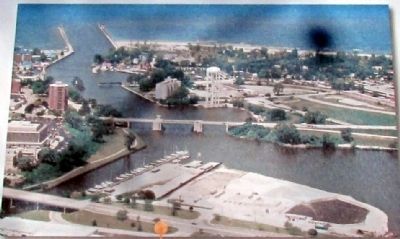
(Middle Photo Caption)
The harbor has been continually updated to accommodate the growing size of commercial vessels. This aerial view shows the harbor in 2007.
Photo: Denise Reeves
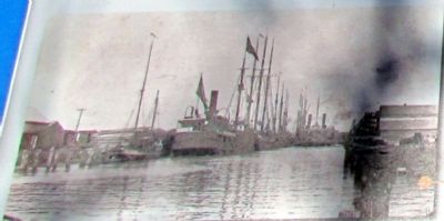
(Lower Photo Caption)
Private investors expanded the port in the 1860s by digging the Benton Harbor Ship Canal, making it one of West Michigan's busiest harbors.
Photo: The Heritage Museum and Cultural Center
Erected by City of St. Joseph, The Heritage Museum and Cultural Center, and the Public History Program at Western Michigan University.
Topics. This historical marker is listed in this topic list: Waterways & Vessels. A significant historical year for this entry is 1838.
Location. 42° 6.684′ N, 86° 28.907′ W. Marker is in St. Joseph, Michigan, in Berrien County. Marker is at the intersection of Lake Boulevard and Port Street, on the left when traveling north on Lake Boulevard. Touch for map. Marker is in this post office area: Saint Joseph MI 49085, United States of America. Touch for directions.
Other nearby markers. At least 8 other markers are within walking distance of this marker. St. Joseph's Firemen (here, next to this marker); Commercial Fishing (within shouting distance of this marker); St. Joseph River Swing Bridge (within shouting distance of this marker); Fort Miami (within shouting distance of this marker); U.S. Lighthouse Supply Depot (about 300 feet away, measured in a direct line); Commercial Shipping (about 400 feet away); Recreational Boating (about 400 feet away); Shipbuilding in the Twin Cities (about 500 feet away). Touch for a list and map of all markers in St. Joseph.
More about this marker. The marker is the fifth of 12 interpretive signs along the St. Joseph Maritime Heritage Trail.
Related markers. Click here for a list of markers that are related to this marker. These are the markers of the
St. Joseph Maritime Heritage Trail. To study the markers in their order along the trail, read each marker in the order shown.
Credits. This page was last revised on June 16, 2016. It was originally submitted on August 29, 2013, by Duane Hall of Abilene, Texas. This page has been viewed 437 times since then and 9 times this year. Photos: 1, 2, 3, 4, 5. submitted on August 29, 2013, by Duane Hall of Abilene, Texas.
