Near Harrodsburg in Mercer County, Kentucky — The American South (East South Central)
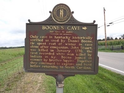
Boone's Cave
Not Open To Public
Erected 1974 by Kentucky Historical Society & Kentucky Department of Highways. (Marker Number 1343.)
Topics and series. This historical marker is listed in these topic lists: Exploration • Settlements & Settlers. In addition, it is included in the Kentucky Historical Society series list. A significant historical month for this entry is January 1770.
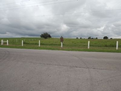
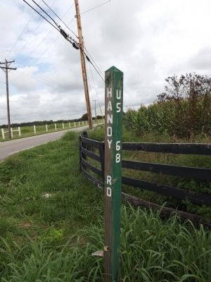
Location. 37° 47.085′ N, 84° 48.518′ W. Marker is near Harrodsburg, Kentucky, in Mercer County. Marker is at the intersection of Lexington Road (U.S. 68) and Handy Pike Road, on the right when traveling west on Lexington Road. Touch for map. Marker is in this post office area: Harrodsburg KY 40330, United States of America. Touch for directions.
Other nearby markers. At least 8 other markers are within 3 miles of this marker, measured as the crow flies. Abraham Chapline Plantation / Rufus Henry Vandarsdall House (about 700 feet away, measured in a direct line); Gabriel Slaughter (approx. half a mile away); Neighbors-Governors / Mercer Governors (approx. 1.6 miles away); John L. Bridges House / Burford Hill (approx. 2 miles away); Muscoe Garnett House (approx. 2.1 miles away); "The Big Spring" (approx. 2.1 miles away); The Big Spring (approx. 2.1 miles away); The Baptist Tabernacle of The Wilderness (approx. 2.1 miles away). Touch for a list and map of all markers in Harrodsburg.
Additional commentary.
1. Location of Cave
The cave is located on private property and is not accessible or viewable from the road. There is no sign on Handy Pike identifying the location. Note To Editor only visible by Contributor and editor
— Submitted June 19, 2022, by Jerry W Moore of Mason, Ohio.
Credits. This page was last revised on June 21, 2022. It was originally submitted on August 31, 2013, by Ken Smith of Milan, Tennessee. This page has been viewed 3,158 times since then and 239 times this year. Photos: 1, 2, 3. submitted on August 31, 2013, by Ken Smith of Milan, Tennessee. • Al Wolf was the editor who published this page.


