Maumee in Lucas County, Ohio — The American Midwest (Great Lakes)
Maumee River Rapids
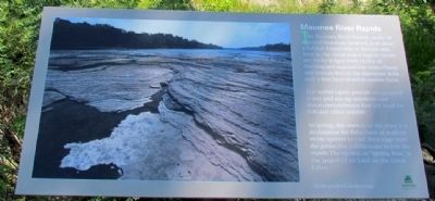
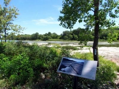
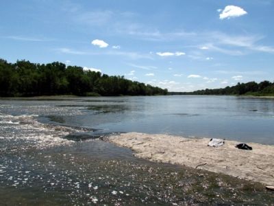
The Maumee River Rapids, made of exposed limestone bedrock, is an alvar, a habitat found only in Europe and here in the Great Lakes region. Alvars are rocky ledges with cycles of flooding and seasonal low water. Plants and animals live on the limestone with only a thin layer of soil to sustain them.
The turbid rapids provide oxygenated water and stir up nutrients and macro-invertebrates that are food for fish and other wildlife.
In spring, this stretch of the river is a destination for fisherman as walleye swim upriver to cast their eggs over the protective cobblestone below the rapids. The spawn, or "Spring Run," is the largest of its kind on the Great Lakes.
Erected by Metroparks of the Toledo Area.
Topics. This historical marker is listed in this topic list: Natural Features.
Location. 41° 32.363′ N, 83° 41.721′ W. Marker is in Maumee, Ohio, in Lucas County. Marker is on North River Road, 0.1 miles east of Jerome Road, on the right when traveling east. Touch for map. Marker is in this post office area: Maumee OH 43537, United States of America. Touch for directions.
Other nearby markers. At least 8 other markers are within walking distance of this marker. Turkey Foot Rock (approx. 0.3 miles away); American Indians at the Battle of Fallen Timbers (approx. 0.3 miles away); Fallen Timbers Battle Monument (approx. 0.3 miles away); Fallen Timbers Battle Memorial (approx. 0.3 miles away); Fallen Timbers (approx. 0.3 miles away); Battle of Fallen Timbers (approx. 0.3 miles away); Fighting Forces (approx. 0.7 miles away); A Long March (approx. 0.7 miles away). Touch for a list and map of all markers in Maumee.
Also see . . . Alvar (Landform) - Wikipedia entry. (Submitted on September 3, 2013.)
Additional commentary.
1. About the marker
At the time this marker profile was originally published, the site was publishing markers about natural features that do not mention historical context. The guidelines have since been tightened.
— Submitted May 23, 2022.
Credits. This page was last revised on May 23, 2022. It was originally submitted on September 3, 2013, by Duane Hall of Abilene, Texas. This page has been viewed 1,190 times since then and 101 times this year. Last updated on May 7, 2022, by Craig Doda of Napoleon, Ohio. Photos: 1, 2, 3. submitted on September 3, 2013, by Duane Hall of Abilene, Texas. • Devry Becker Jones was the editor who published this page.


