Lebanon in Wilson County, Tennessee — The American South (East South Central)
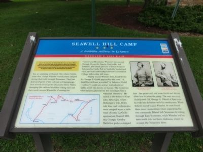
Seawell Hill Camp
A deathlike stillness in Lebanon
— Wheeler's 1864 Raid —
Trying to join Wheeler here, Confederate Lt. George B. Guild approached the town. “A deathlike stillness prevailed” in Lebanon, Guild recalled. “I could see neither individuals nor lights about the streets or houses. The numerous white houses glistened in the moonlight like a whitened cemetery.” He called at the house of Capt. John McGregor, where McGregor’s wife, Dolly, told him that confederates were camped about a mile west of town. As Guild approached Seawell Hill, 4th Georgia Cavalry Battalion pickets stopped him. The pickets did not know Guild and did not allow him to enter the camp. The next morning, Guild joined Col. George G. Dibrell of Sparta as he rode into Lebanon with his cavalrymen. When Dibrell moved to join Wheeler, he soon found there were Union infantrymen separating the two commands. Dibrell left Tennessee by riding through East Tennessee, while Wheeler led his men out into northern Alabama, where he crossed the Tennessee River.
(Side bar at the top left)
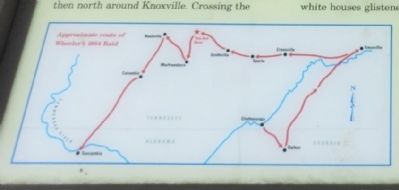
On August 10, 1864, Confederate Gen. John Bell Hood, defending Atlanta, Georgia against Union Gen. William T. Sherman’s army, sent Gen. Joseph Wheeler and 4,000 cavalrymen to cut Sherman’s lines of communication. Wheeler destroyed railroad track in Georgia before Union infantry forced him into East Tennessee. He and his men turned west, destroyed track south of Nashville, and then fled into Alabama. Union crews quickly repaired the damaged track, rendering the raid, which ended on September 10, largely ineffective.
Erected by Tennessee Civil War Trails.
Topics and series. This historical marker is listed in this topic list: War, US Civil. In addition, it is included in the Tennessee Civil War Trails series list. A significant historical month for this entry is September 1866.
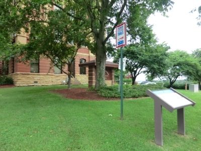
Location. 36° 12.783′ N, 86° 18.383′ W. Marker is in Lebanon, Tennessee, in Wilson County. Marker is at the intersection of North Castle Heights Avenue and Hill Street on North Castle Heights Avenue. Touch for map. Marker is in this post office area: Lebanon TN 37087, United States of America. Touch for directions.
Other nearby markers. At least 8 other markers are within walking distance
of this marker. Lest We Forget / One Nation Under God (within shouting distance of this marker); Castle Heights Military Academy Supreme Sacrifice Monument (within shouting distance of this marker); Judge Nathan Green, Sr. (approx. Ľ mile away); Castle Heights Military Academy (approx. Ľ mile away); Site of Robert H. Hatton Home (approx. half a mile away); Cumberland University Founded in 1842 (approx. 0.6 miles away); City of Lebanon Memorial on the War Against Terrorism (approx. 0.6 miles away); McClain Circle (approx. 0.7 miles away). Touch for a list and map of all markers in Lebanon.
Credits. This page was last revised on June 16, 2016. It was originally submitted on September 4, 2013, by Don Morfe of Baltimore, Maryland. This page has been viewed 656 times since then and 7 times this year. Photos: 1, 2, 3. submitted on September 4, 2013, by Don Morfe of Baltimore, Maryland. • Al Wolf was the editor who published this page.


