Schaumburg in Cook County, Illinois — The American Midwest (Great Lakes)
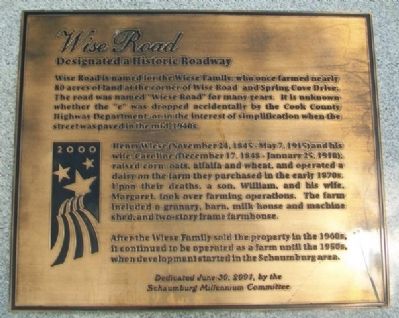
Wise Road
Designated a Historic Roadway
Wise Road is named for the Wiese Family, who once farmed nearly 80 acres of land at the corner of Wise Road and Spring Cove Drive. The road was named "Wiese Road" for many years. It is unknown whether the "e" was dropped accidentally by the Cook County Highway Department, or in the interest of simplification when the street was paved in the mid-1940s.
Henry Wiese (November 24, 1845-May 7, 1915) and his wife, Caroline (December 17, 1848-January 15, 1918), raised corn, oats, alfalfa and wheat, and operated a dairy on the farm they purchased in the early 1870s. Upon their deaths, a son, William, and his wife, Margaret, took over farming operations. The farm included a granary, barn, milk house and machine shed, and two-story frame farmhouse.
After the Wiese Family sold the property in the 1940s, it continued to be operated as a farm until the 1950s, when development started in the Schaumburg area.
Dedicated June 30, 2001
Erected 2001 by Schaumburg Millenium Committee.
Topics. This historical marker is listed in these topic lists: Agriculture • Roads & Vehicles • Settlements & Settlers. A significant historical date for this entry is June 30, 1958.
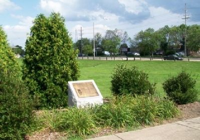
Location. 42° 0.315′ N, 88° 5.59′ W. Marker is in Schaumburg, Illinois, in Cook County. Marker is at the intersection of Spring Cove Drive and Wise Road, on the right when traveling north on Spring Cove Drive. Touch for map. Marker is in this post office area: Schaumburg IL 60173, United States of America. Touch for directions.
Other nearby markers. At least 8 other markers are within 8 miles of this marker, measured as the crow flies. Veterans' Memorial (approx. 2.8 miles away); Streamwood Veterans Memorial (approx. 4 miles away); a different marker also named Veterans Memorial (approx. 4.7 miles away); Reverend J. Ward Morrison Boulevard (approx. 5.1 miles away); Old Mill (approx. 6.3 miles away); Army Trail Road (approx. 7.2 miles away); Site of Lutheran Teacher’s Seminary (approx. 7.2 miles away); Kinderheim Arch (approx. 7.3 miles away).
Credits. This page was last revised on January 30, 2023. It was originally submitted on September 8, 2013, by William Fischer, Jr. of Scranton, Pennsylvania. This page has been viewed 807 times since then and 57 times this year. Last updated on April 20, 2020, by Jason Voigt of Glen Carbon, Illinois. Photos: 1, 2. submitted on September 8, 2013, by William Fischer, Jr. of Scranton, Pennsylvania. • Devry Becker Jones was the editor who published this page.

