Mystic in Stonington in New London County, Connecticut — The American Northeast (New England)
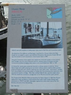
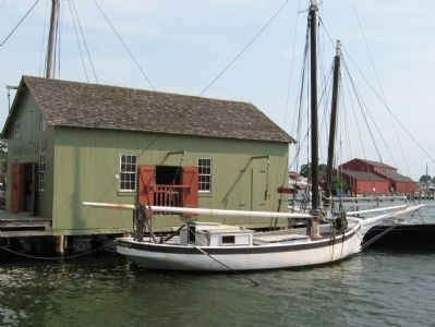
Oyster Sloop Nellie
Built: 1891, Smithtown, NY
Length on deck: 32’ 4”
Beam: 12’ 9”
Draft: 2’ 4”
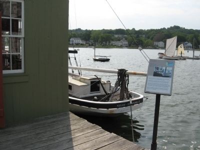
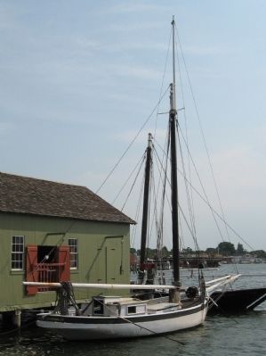
Nellie represents hundreds of sailing oyster boats used in New York and Connecticut waters.
She fished from Port Jefferson and Patchogue, Long Island for 10 years before John Ryle bought her to dredge for oysters near Stamford, Connecticut. She was one of nearly 350 sailing craft licensed to work Connecticut’s natural oyster beds in 1900.
Along the Connecticut shore, oysters have settled over thousands of years to form natural beds. Dredges were the most productive tools for catching oysters. To protect the beds, Connecticut prohibited dredging under power on its natural beds from 1881 to 1969.
As demand for oysters grew, oystermen learned to cultivate oysters in undersea “farms.” Natural beds were public property, but sea bottom without oysters could be held as private property. Private beds were used for spawning new crops (often using “seed oysters” dredged from natural beds) or for growing oysters to market size. On private grounds, oystermen could use powered vessels to dredge. After Ryle outfitted Nellie with a gasoline engine about 1914, she would have worked as a dredge boat on his 78 acres of private oyster ground.
The Friends of the Nellie A. Ryle purchased her for Mystic Seaport in 1964. The Museum replaced her sloop rig, based on measurements from other oyster sloops. During major restorations in 1970-71 and 2001, shipwrights replaced her entire deck, most of her ribs (frames), and some of her hull planking.
Erected by Mystic Seaport Museum. (Marker Number 1964.1551.)
Topics. This historical marker is listed in this topic list: Waterways & Vessels. A significant historical year for this entry is 1891.
Location. 41° 21.584′ N, 71° 57.918′ W. Marker is in Stonington, Connecticut, in New London County. It is in Mystic. Marker can be reached from the intersection of Greenmanville Avenue (Connecticut Route 27) and Bruggeman Place, on the right when traveling south. Located in Mystic Seaport. Touch for map. Marker is at or near this postal address: 75 Greenmanville Avenue, Mystic CT 06355, United States of America. Touch for directions.
Other nearby markers. At least 8 other markers are within walking distance of this marker. "Hobey's Dock" (a few steps from this marker); Mast of the Cutter Nebula (a few steps from this marker); Restoring the L.A. Dunton (within shouting distance of this marker); Fish Flake (within shouting distance of this marker); L.A. Dunton (within shouting distance of this marker); a different marker also named L.A. Dunton
Also see . . . Mystic Seaport, The Museum of America and the Sea. (Submitted on September 8, 2013, by Michael Herrick of Southbury, Connecticut.)
Credits. This page was last revised on June 29, 2023. It was originally submitted on September 8, 2013, by Michael Herrick of Southbury, Connecticut. This page has been viewed 650 times since then and 16 times this year. Photos: 1. submitted on September 8, 2013, by Michael Herrick of Southbury, Connecticut. 2. submitted on June 28, 2023, by Devry Becker Jones of Washington, District of Columbia. 3, 4, 5. submitted on September 8, 2013, by Michael Herrick of Southbury, Connecticut.
