West Ridge in Chicago in Cook County, Illinois — The American Midwest (Great Lakes)
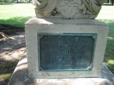
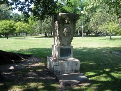
1877 Keystone from City Hall Building
Erected 1927 by Ridge Avenue Park Commissioners.
Topics. This historical marker is listed in this topic list: Government & Politics. A significant historical year for this entry is 1877.
Location. 42° 0.543′ N, 87° 41.578′ W. Marker is in Chicago, Illinois, in Cook County. It is in West Ridge. Marker can be reached from West Lunt Avenue east of North Rockwell Street, on the left when traveling east. Touch for map. Marker is at or near this postal address: 2500 West Lunt Avenue, Chicago IL 60645, United States of America. Touch for directions.
Other nearby markers. At least 8 other markers are within 2 miles of this marker, measured as the crow flies. Philip Rogers Home Site (within shouting distance of this marker); Indian Boundary Park (within shouting distance of this marker); Indian Boundary Village (about 300 feet away, measured in a direct line); The Spirit of the Fighting Yank (approx. 0.8 miles away); Indian Boundary Lines (approx. one mile away); Burr Tillstrom (approx. 1.4 miles away); Emil Bach House (approx. 1˝ miles away); George S. Bangs (approx. 1.6 miles away). Touch for a list and map of all markers in Chicago.
More about this marker. In Indian Boundary Park - can enter Park from North Campbell Avenue.
Also see . . . Chicago City Hall, 121 North LaSalle Street, Chicago, Cook County, IL. The Historic American Buildings Survey record for the Chicago City Hall, documenting both the demolition of the sixth city hall (as represented by the keystone and its marker), and the construction of its successor. Includes more than 30 pages of notes and histories of Chicago's seven city halls. (Submitted on September 11, 2013.)

Photographed By Unknown, October 16, 1908
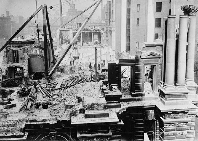
3. Demolition of City Hall No. 6, 1908
This image, courtesy of the Historic American Buildings Survey, shows the demolition of the sixth Chicago City Hall in October, 1908. Note at the very bottom of the picture on the right, a keystone is visible, very much similar to the one mounted on the marker's monument. Examination of the archival quality image (see link above) shows the keystone to be virtually identical to the keystone on the marker's monument, although the existence of more than one keystone of the same design should not be ruled out.
Credits. This page was last revised on January 30, 2023. It was originally submitted on September 10, 2013. This page has been viewed 1,024 times since then and 9 times this year. Photos: 1, 2. submitted on September 10, 2013. 3. submitted on September 11, 2013. • Al Wolf was the editor who published this page.

