Near Pottsville in Schuylkill County, Pennsylvania — The American Northeast (Mid-Atlantic)
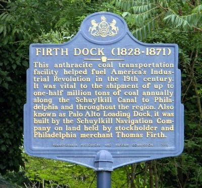
Firth Dock (1828-1871)
Erected 1999 by Pennsylvania Historical and Museum Commission.
Topics and series. This historical marker is listed in these topic lists: Industry & Commerce • Waterways & Vessels. In addition, it is included in the Pennsylvania Historical and Museum Commission series list.
Location. 40° 41.438′ N, 76° 10.252′ W. Marker is near Pottsville, Pennsylvania, in Schuylkill County. Marker is on Weigland Boulevard (U.S. 209) 0.8 miles north of Anderson Street. Touch for map. Marker is in this post office area: Pottsville PA 17901, United States of America. Touch for directions.
Other nearby markers. At least 8 other markers are within 2 miles of this marker, measured as the crow flies. Veterans of Port Carbon (approx. 0.4 miles away); Schuylkill Canal (approx. 0.4 miles away); American House - C.F. Jackson (approx. 1.3 miles away); Architectural Elements of the Former J.G. Royal Building (approx. 1.3 miles away); The Partridge House (approx. 1.3 miles away); Trinity Episcopal Church (approx. 1.3 miles away); Pottsville Downtown Historic District (approx. 1.4 miles away); John Pott (approx. 1.4 miles away). Touch for a list and map of all markers in Pottsville.
Also see . . . History of the Schuylkill Navigation System. The system was most prosperous between 1835 and 1841 although its record tonnage, nearly two million tons, occurred in 1859. During the second half of the 19th century the rise of the railroad, floods, droughts, and a miners' strike contributed to the downfall of the system. (Submitted on September 14, 2013, by PaulwC3 of Northern, Virginia.)
Credits. This page was last revised on June 16, 2016. It was originally submitted on September 14, 2013, by PaulwC3 of Northern, Virginia. This page has been viewed 675 times since then and 38 times this year. Photos: 1, 2. submitted on September 14, 2013, by PaulwC3 of Northern, Virginia.
Editor’s want-list for this marker. Photos of the ruins of the canal and Firth Dock at the northern terminus of the canal • Can you help?

