Near Nanticoke in Luzerne County, Pennsylvania — The American Northeast (Mid-Atlantic)
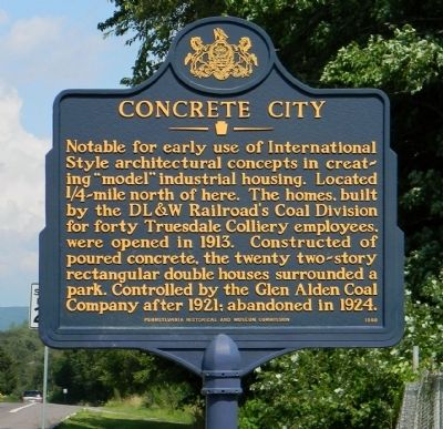
Concrete City
Erected 1998 by Pennsylvania Historical and Museum Commission.
Topics and series. This historical marker is listed in this topic list: Notable Buildings. In addition, it is included in the Pennsylvania Historical and Museum Commission series list. A significant historical year for this entry is 1913.
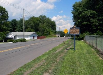
Location. 41° 11.132′ N, 75° 58.839′ W. Marker is near Nanticoke, Pennsylvania, in Luzerne County. Marker is at the intersection of Front Street (State Road 2010) and Phillip Street, on the right when traveling east on Front Street. Touch for map. Marker is in this post office area: Nanticoke PA 18634, United States of America. Touch for directions.
Other nearby markers. At least 8 other markers are within 2 miles of this marker, measured as the crow flies. Pete Gray Wyshner (about 700 feet away, measured in a direct line); Luzerne County Community College Walk of Honor (approx. one mile away); Walk of Honor September 11th Memorial (approx. one mile away); Vietnam War Memorial (approx. 1.4 miles away); Nanticoke (approx. 1.4 miles away); Dr. Stanley J. Dudrick (approx. 1.4 miles away); John S. Fine (approx. 1.4 miles away); Veterans Memorial (approx. 1½ miles away). Touch for a list and map of all markers in Nanticoke.
Also see . . . The haunting remains of Concrete City | Times News Online. Concrete City, just outside of Nanticoke, was the first phase of a new age in mining villages when the Delaware, Lackawanna and Western Railroad built this development of 20 buildings in 1911. It was a time when the companies were experimenting with giving their best workers better living conditions. (Submitted on September 16, 2013, by PaulwC3 of Northern, Virginia.)
Credits. This page was last revised on June 16, 2016. It was originally submitted on September 15, 2013, by PaulwC3 of Northern, Virginia. This page has been viewed 911 times since then and 211 times this year. Photos: 1, 2. submitted on September 15, 2013, by PaulwC3 of Northern, Virginia.

