Near Gulf Shores in Baldwin County, Alabama — The American South (East South Central)
Citadel (1825-1865)
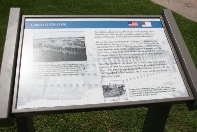
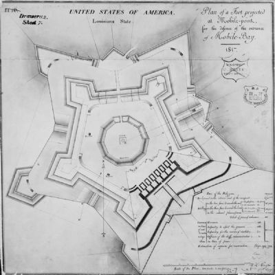
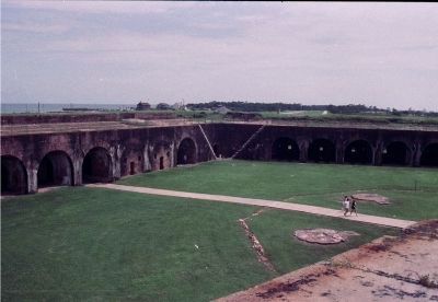
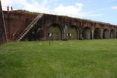
The Citadel, a large ten sided brick and wood structure, once dominated the Fortís parade ground. Completed in 1825 as a defensive barracks, it was capable of housing 400 soldiers.
During the Union bombardment on August 22, 1864, the pine beams used in the construction of the citadelís roof caught fire and burned out of control. The fire forced the Confederates to dump approximately 60,000 pounds of cannon powder into the fortís water cistern to prevent it from exploding. On the morning of August 23rd, as the citadel continued to burn, Fort Morganís garrison surrendered to Union forces.
After the surrender, portions of the Citadel walls were used as a source of brick for repairs to the damage sustained during the siege. The remaining remnants of the structure were razed in the 1880ís and the debris used as a break water on the east end of Daulphin Island.
Topics. This historical marker is listed in these topic lists: Forts and Castles • War, US Civil. A significant historical year for this entry is 1825.
Location. 30° 13.7′ N, 88° 1.368′ W. Marker is near Gulf Shores, Alabama, in Baldwin County. Marker can be reached from Fort Morgan Road (Alabama Route 180) 1.7 miles west of Dune Drive when traveling west. Located in Fort Morgan State Historic Park. Touch for map. Marker is at or near this postal address: 51 Highway 180 West, Gulf Shores AL 36542, United States of America. Touch for directions.
Other nearby markers. At least 8 other markers are within walking distance of this marker. The Citadel (a few steps from this marker); The Battle of Mobile Bay (within shouting distance of this marker); a different marker also named The Battle of Mobile Bay (within shouting distance of this marker); a different marker also named The Battle of Mobile Bay (within shouting distance of this marker); Panama Mount (within shouting distance of this marker); Battery Thomas (1898-1917) (about 300 feet away, measured in a direct line); The Pride of Seven Flags (about 300 feet away); 6.4Ē (100 pounder) Parrott Rifle / 7Ē Brooke Rifle (about 300 feet away). Touch for a list and map of all markers in Gulf Shores.
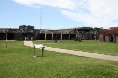
More about this marker. This marker is located within the walls of historic Fort Morgan. The marker stands on the north side of the fort's parade field to the left of the sally port (entrance).
Photographed By Timothy Carr, June 19, 2013
3. Citadel (1825-1865) Large Image
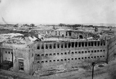
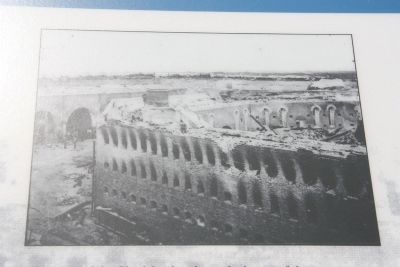
This view of the Citadel ruins shows the layout of the structure. Sitting in the center of Fort Morgan, the structure consisted of ten sides with each side containing a room. Three levels of rifle loop holes provided defense of the structure if the fort should fall. The center of the Citadel was compose of a courtyard with two water cisterns and its own defensive rifle loopholes in case the Citadel was stormed.
Photographed By Timothy Carr, June 19, 2013
4. Citadel (1825-1865) Small Image
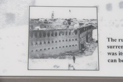
The ruins of Fort Morganís Citadel shortly after the fortís surrender to Union forces. The Mobile Point Lighthouse, which was itself heavily damaged in the fighting and later torn down, can be seen over the top of the fort.
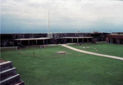
Photographed By Timothy Carr, 1988
8. Battery Duportail, a Endicott Period Coastal Defenses was built over half of the Citalel's footings
Battery Duportail constructed between 1898 and 1900. Following the Endicott System construction practice, incorporating concrete batteries into existing fortifications utilizing the old brick fort for additional protection.
The design improvement of guns used during the American Civil War proved that brick and mortar forts like Fort Morgan obsolete. For a period of time after the American Civil War, the United States coastal defenses fell into disrepair and neglect. Many of then foreign powers were building heavily armored warships, armed with advance and powerful guns.
In 1885 President Grover Cleveland appointed a joint military and civilian board to investigate and make recommendations on the modernizations of harbors and coastal defenses in the United States. The Board of Fortifications was headed by Secretary of War, William Crowninshield Endicott. Endicottís board recommended a 127 million dollar construction program that included new forts with breech-loading cannons, mortars, floating batteries, and submarine mines for 29 locations along the U.S. coast.
Battery Duportail was one of six batteries built at Mobile Point during that large-scale modernization. Battery Duportail was named after the Continental Armyís Chief of Engineers, Louis L. Duportail. The two story reinforced concrete structure was armed with two 12 inch disappearing guns. The Battery was in service from 1901 until the deactivation of Fort Morgan Military Installation in 1924. The guns at Battery Duportail remained in place until 1942 when they were removed for scrape.
Credits. This page was last revised on July 25, 2018. It was originally submitted on September 20, 2013, by Timothy Carr of Birmingham, Alabama. This page has been viewed 1,823 times since then and 82 times this year. Photos: 1, 2, 3, 4, 5, 6, 7, 8, 9. submitted on September 20, 2013, by Timothy Carr of Birmingham, Alabama. • Bernard Fisher was the editor who published this page.
