Austin in Travis County, Texas — The American South (West South Central)
Pilot Knob
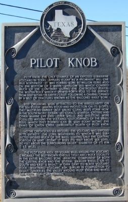
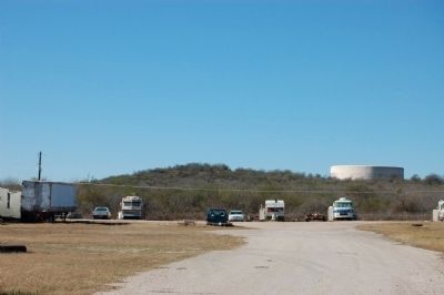
Pilot Knob, the only example of an exposed submarine volcano in Texas, appears today as a prominent hill one mile northwest. It was formed some 80 million years ago on the bottom of a warm shallow sea which covered much of the continent during the Cretaceous period. The molten rock which it spewed forth rose to the surface from deep within the earth's crust. Following a channel opened by a belt of fractures known as the Balcones Fault zone.
Reef organisms were attracted to the irregularity on the sea floor. Seeking food and protection on its slopes, they multiplied rapidly, not unlike coral reefs form now in the south Pacific Ocean. As corals, starfish, oysters and other marine life died, their shells and skeletons were fossilized around the volcano. Outcroppings of the small reefs which they formed can be seen today along the banks of Onion Creek, immediately north of Pilot Knob.
As the Cretaceous sea receded, the volcano was exposed in its entirety. The long weathering to which it was subjected eroded much of the mass, leaving only the central portion or vent. Today it rises 710 feet above sea level, 180 feet above the surrounding valley. Diameter of its rim is 1.5 miles.
The Pilot Knob area, 29 square miles around the volcano, is probably the best known igneous (volcanic) rock locality in the entire Balcones zone. Principal component of both the central knob and the several smaller knolls on its south and east is basalt, a dark gray to black volcanic rock. Weathered volcanic ash, similar in composition to basalt, underlies the valley around Pilot Knob and makes the land rich for farming.
Erected 1963 by Texas Highway Department. (Marker Number 16145.)
Topics. This historical marker is listed in these topic lists: Landmarks • Natural Features.
Location. Marker has been reported missing. It was located near 30° 9.001′ N, 97° 41.825′ W. Marker was in Austin, Texas, in Travis County. Marker was at the intersection of U.S. 183 and Farm to Market Road 1625, on the right when traveling south on U.S. 183. I believe this marker to be missing, probably a result of the road work being down in that area. The lat/long provided here agrees with where I remember seeing the marker. But I have been unable able to locate the marker in the last year or so. Touch for map. Marker was in this post office area: Austin TX 78719, United States of America. Touch for directions.
Other nearby markers. At least 8 other markers are within 6 miles of this location, measured as the crow flies. Collins Cemetery (approx. 1˝ miles away); Moore’s Crossing Bridge (approx. 2.4 miles away); Santiago del Valle Grant (approx. 2.8 miles away); Richard Overton Healing Garden (approx. 3.9 miles away); Elroy (approx. 3.9 miles away); Dr. Jacob Tally Wilhite (approx. 4.2 miles away); Del Valle Army Air Base (approx. 4.7 miles away); Onion Creek Lodge 220, A.F. & A.M. (approx. 5.3 miles away). Touch for a list and map of all markers in Austin.
Also see . . . Wikipedia entry for Pilot Knob. (Submitted on January 23, 2010, by Keith Peterson of Cedar Park, Texas.)
Credits. This page was last revised on February 1, 2023. It was originally submitted on January 23, 2010. This page has been viewed 4,228 times since then and 245 times this year. Last updated on October 29, 2020, by Richard Denney of Austin, Texas. Photos: 1, 2. submitted on January 23, 2010, by Keith Peterson of Cedar Park, Texas. • J. Makali Bruton was the editor who published this page.
Editor’s want-list for this marker. A wide view photo of the marker area. • Can you help?

