Osawatomie in Miami County, Kansas — The American Midwest (Upper Plains)
Battle of Osawatomie
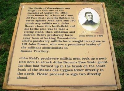
The Battle of Osawatomie was fought on this site on the morning of August 30, 1856. John Brown led a force of about 30 Free State guerilla fighters in battle against John Reid and 250 proslavery militia men. John Brown chose this battlefield, and his battle plan was to take a strong stand, then withdraw and distract Reid's proslavery force away from attacking Osawatomie. Reid's proslavery militia force sought to capture or kill John Brown, who was a prominent leader of the militant abolitionists in Kansas Territory.
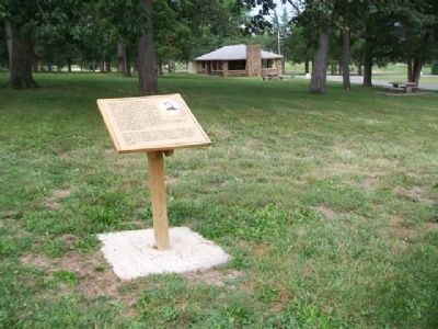
John Reid's proslavery militia men took up a position here to attack John Brown's Free State guerillas that had formed up in the brush on the south bank of the Marais des Cygnes River directly to the north. Please proceed to sign two directly ahead.
Erected 2012 by Kansas State Historical Society. (Marker Number 1.)
Topics. This historical marker is listed in this topic list: Notable Events. A significant historical year for this entry is 1856.
Location. 38° 29.924′ N, 94° 57.544′ W. Marker is in Osawatomie, Kansas, in Miami County. Marker is about 100 feet east of the Adair Cabin, the centerpiece of the John Brown Museum State Historic Site, in John Brown Memorial Park, with entrance off Main Street at 10th Street. Touch for map . Marker is in this post office area: Osawatomie KS 66064, United States of America. Touch for directions.
Other nearby markers. At least 8 other markers are within walking distance of this marker. T. B. Williams and J. B. Remington (here, next to this marker); a different marker also named Battle of Osawatomie (a few steps from this marker); John Brown Statue (a few steps from this marker); John Brown Battleground (within shouting distance of this marker); a different marker also named Battle of Osawatomie (within shouting distance of this marker); John Brown of Kansas (about 300 feet away, measured in a direct line); a different marker also named Battle of Osawatomie (about 300 feet away); Site of the Battle of Osawatomie (about 400 feet away). Touch for a list and map of all markers in Osawatomie.
Also see . . .
1. John Brown Museum State Historic Site. Kansas Historical Society website entry (Submitted on October 13, 2013, by William Fischer, Jr. of Scranton, Pennsylvania.)
2. Battle of Osawatomie Primary Documents. Internet Archive Wayback Machine entry (Submitted on October 13, 2013, by William Fischer, Jr. of Scranton, Pennsylvania.)
Credits. This page was last revised on January 22, 2022. It was originally submitted on October 13, 2013, by William Fischer, Jr. of Scranton, Pennsylvania. This page has been viewed 565 times since then and 22 times this year. Photos: 1, 2. submitted on October 13, 2013, by William Fischer, Jr. of Scranton, Pennsylvania.

