Westminster in Adams County, Colorado — The American Mountains (Southwest)
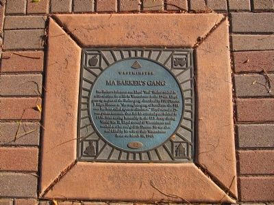
Ma Barker's Gang
Westminster
— [Lloyd William Barker] —
Erected 2002 by City of Westminster Historical Marker Program Capital Improvement Project. (Marker Number 12.)
Topics. This historical marker is listed in these topic lists: Industry & Commerce • War, World II. A significant historical month for this entry is March 1907.
Location. 39° 49.748′ N, 105° 2.327′ W. Marker is in Westminster, Colorado, in Adams County. Marker is on West 73rd Avenue, 0.3 miles west of Lowell Boulevard, on the right when traveling west. Located on the side walk of a small park. Touch for map. Marker is at or near this postal address: 3875 West 73rd Avenue, Westminster CO 80030, United States of America. Touch for directions.
Other nearby markers. At least 8 other markers are within 6 miles of this marker, measured as the crow flies. WFD Volunteers 1934 - 2000 (within shouting distance of this marker); Gold Was Discovered (approx. 3.1 miles away); Elitch Theatre (approx. 4.2 miles away); Theatre Alumni (approx. 4.2 miles away); Roger W. Woodbury Branch - Denver Public Library (approx. 4.6 miles away); Veterans Memorial Flag Pole (approx. 4.7 miles away); Platte River Trail (approx. 5 miles away); Manhattan Beach (approx. 5.4 miles away).
Credits. This page was last revised on October 23, 2019. It was originally submitted on October 20, 2013, by Marvin Seibert of Ketchikan, Alaska. This page has been viewed 1,336 times since then and 71 times this year. Photo 1. submitted on October 20, 2013, by Marvin Seibert of Ketchikan, Alaska. • Syd Whittle was the editor who published this page.
Editor’s want-list for this marker. Wide area view of the marker and its surroundings. • • Can you help?
