Holden in Millard County, Utah — The American Mountains (Southwest)
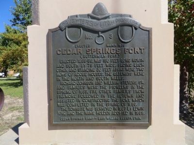
Cedar Springs Fort
(Buttermilk Fort)
Richard Johnson and William Stevens, Sr. and families were the pioneers in the spring of 1855, five other families from Fillmore followed in the autumn and assisted in constructing the fort, which was completed in the spring of 1856.
The townsite was surveyed in 1867 by Edwin King and the name Holden adopted in 1869.
Erected 1935 by Cedar Springs Camp, Daughters of Utah Pioneers – East Millard County, Utah. (Marker Number 3.)
Topics and series. This historical marker is listed in these topic lists: Forts and Castles • Settlements & Settlers. In addition, it is included in the Daughters of Utah Pioneers series list. A significant historical year for this entry is 1855.
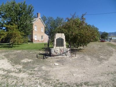
Location. 39° 6.062′ N, 112° 16.12′ W. Marker is in Holden, Utah, in Millard County. Marker is at the intersection of 100 East and 100 North, on the left when traveling east on 100 East. Marker is on the northeast corner. Touch for map. Marker is in this post office area: Holden UT 84636, United States of America. Touch for directions.
Other nearby markers. At least 8 other markers are within 10 miles of this marker, measured as the crow flies. Heritage Bell (about 300 feet away, measured in a direct line); Holden (approx. half a mile away); Fillmore's Adobe Church (approx. 8.9 miles away); Dominguez - Escalante Trail (approx. 8.9 miles away); Capitol (approx. 8.9 miles away); Fillmore Pioneer Fort (approx. 9.6 miles away); Utah’s First Capitol (approx. 9.7 miles away); Land of the Yuta (approx. 9.7 miles away). Touch for a list and map of all markers in Holden.
Credits. This page was last revised on June 16, 2016. It was originally submitted on October 21, 2013, by Bill Kirchner of Tucson, Arizona. This page has been viewed 561 times since then and 36 times this year. Photos: 1, 2. submitted on October 21, 2013, by Bill Kirchner of Tucson, Arizona. • Syd Whittle was the editor who published this page.

