Near Sharpsburg in Washington County, Maryland — The American Northeast (Mid-Atlantic)
Jackson's Command
Anderson's Brigade, D.H. Hill's Division
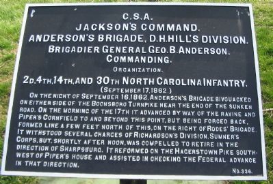
Jackson's Command,
Anderson's Brigade, D.H. Hill's Division.
Brigadier General Geo. B. Anderson,
Commanding.
Organization.
2d, 4th, 14th, and 30th North Carolina Infantry.
(September 17, 1862.)
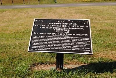
On the night of September 16, 1862, Anderson's Brigade bivouacked on either side of the Boonsboro Turnpike near the end of the ravine and Piper's Cornfield to and beyond this point, but being forced back, formed line a few feet north of this on the right of Rodes' Brigade. It withstood several charges of Richardson's Division, Sumner's Corps, but, shortly after noon, was compelled to retire in the direction of Sharpsburg. It reformed on the Hagerstown Pike southwest of Piper's house and assisted in checking the Federal advance in that direction.
Erected by Antietam Battlefield Board. (Marker Number 336.)
Topics and series. This historical marker is listed in this topic list: War, US Civil. In addition, it is included in the Antietam Campaign War Department Markers series list. A significant historical date for this entry is September 16, 1862.
Location. 39° 28.227′ N, 77° 44.305′ W. Marker is near Sharpsburg, Maryland, in Washington County. Marker is on Richardson Avenue, on the left when traveling east. Touch for map . Marker is in this post office area: Sharpsburg MD 21782, United States of America. Touch for directions.
Other nearby markers. At least 8 other markers are within walking distance of this marker. Brigadier General George B. Anderson (a few steps from this marker); 132nd Pennsylvania Volunteer Infantry (within shouting distance of this marker); Anderson’s Division, Longstreet’s Command (within shouting distance of this marker); Richardson's Division, Second Army Corps (about 300 feet away, measured in a direct line); "The End of the Confederacy Was In Sight" (about 300 feet away); Heaps Upon Heaps Were There in Death's Embrace (about 300 feet away); Second Army Corps (about 300 feet away); "These Men Are Going to Stay Here" (about 300 feet away). Touch for a list and map of all markers in Sharpsburg.
Also see . . .
1. Antietam Battlefield. National Park Service site. (Submitted on April 8, 2008, by Craig Swain of Leesburg, Virginia.)
2. Anderson's North Carolina Brigade. Anderson was mortally wounded during the fighting along the Sunken Road. Col. Charles Tew of the 2nd North Carolina succeeded him, but was killed soon afterward, passing command on to Col. Risden Tyler Bennett of the 14th North Carolina. (Submitted on April 8, 2008, by Craig Swain of Leesburg, Virginia.)
3. George B. Anderson. George Burgwyn Anderson (April 12, 1831 – October 16, 1862) was a career military officer, serving first in the antebellum U.S. Army and then dying from wounds inflicted during the American Civil War while a general officer in the Confederate Army. He was among six generals killed or mortally wounded at the Battle of Antietam in September 1862. (Submitted on September 27, 2015, by Brian Scott of Anderson, South Carolina.)
Photographed By Craig Swain, March 29, 2008
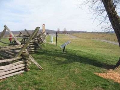
3. Anderson's Brigade Tablet and the Anderson Mortuary Monument
The brigade tablet was removed for maintenance in the summer of 2007, but has been restored. The location of the tablet and monument is roughly the center point of the Brigade's battle line along the Sunken Road.
Photographed By Craig Swain, March 29, 2008
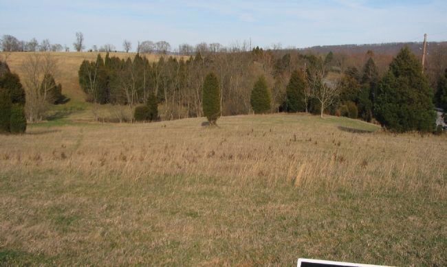
5. Anderson's Brigade Early Morning Position
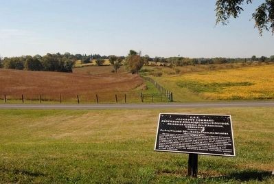
Early in the morning of the battle, Anderson's Brigade defended the Boonsboro Pike and approaches from the Middle Bridge. At the time of the battle the Newcomer House stood in the right foreground here. The modern Boonsboro Pike, Maryland 34, runs on the right side of the photo. The path of the road at the time of the battle was about 25 to 30 yards further south. As the battle to the north developed, Anderson's Brigade moved out of the ravine here, up the farm lane (what is today Richardson Avenue), and into position along the Sunken Road. This photo was taken from War Department Tablet 86 (Fourth U.S. Infantry) along the south leg of Richardson Avenue.
Photographed By Craig Swain, August 5, 2007
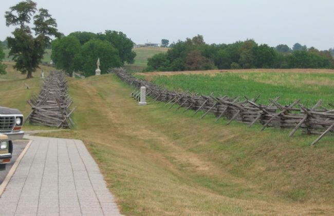
6. Anderson's Brigade on the Sunken Road
Anderson's Brigade occupied a position running from where the modern Observation Tower stands, northwest to a point where the road turned east, where Rodes' Brigade defended. Anderson's Brigade met the Federal attacks of French's and Richardson's Divisions from about 9 a.m. to noon. This photo was taken looking northwest down the Sunken Road from the parking area for the Observation Tower.
Photographed By Brian Scott, 1862
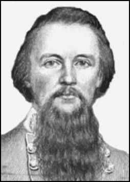
7. Brig. General George B. Anderson (1831-1862)
During the Battle of Antietam, Anderson's North Carolinians defended a portion of the Sunken Road (known as "Bloody Lane") against repeated Union attacks. A Minié ball struck Anderson near his ankle, injuring it badly. Anderson was transported to Shepherdstown and then by wagon up the Shenandoah Valley to Staunton, Virginia, to recuperate. He was eventually shipped by train to Raleigh, North Carolina, where he died following surgery to amputate the infected foot.
Credits. This page was last revised on October 25, 2017. It was originally submitted on April 8, 2008, by Craig Swain of Leesburg, Virginia. This page has been viewed 1,213 times since then and 18 times this year. Photos: 1. submitted on April 8, 2008, by Craig Swain of Leesburg, Virginia. 2. submitted on September 27, 2015, by Brian Scott of Anderson, South Carolina. 3. submitted on April 8, 2008, by Craig Swain of Leesburg, Virginia. 4. submitted on September 27, 2015, by Brian Scott of Anderson, South Carolina. 5, 6. submitted on April 8, 2008, by Craig Swain of Leesburg, Virginia. 7. submitted on September 27, 2015, by Brian Scott of Anderson, South Carolina.
