Wilson-Conococheague in Washington County, Maryland — The American Northeast (Mid-Atlantic)
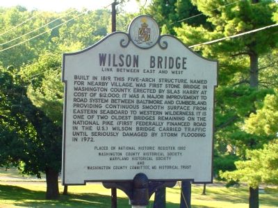
Wilson Bridge
Link Between East and West
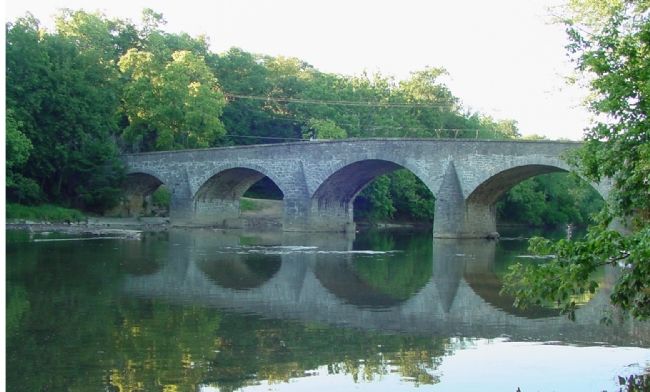
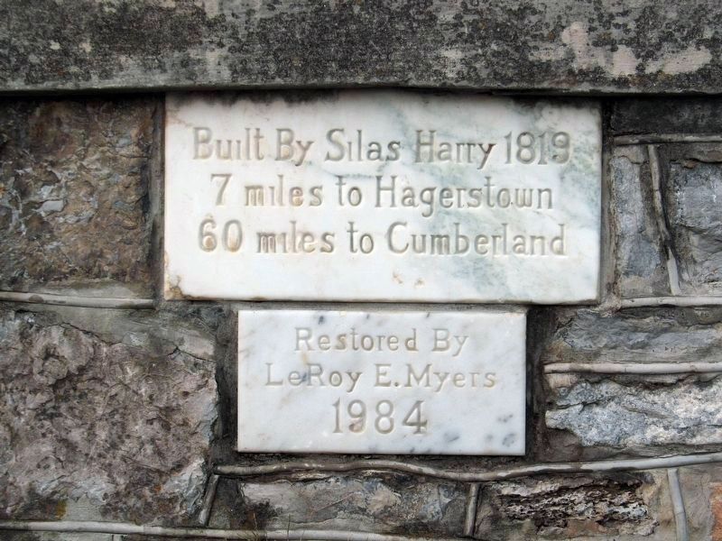
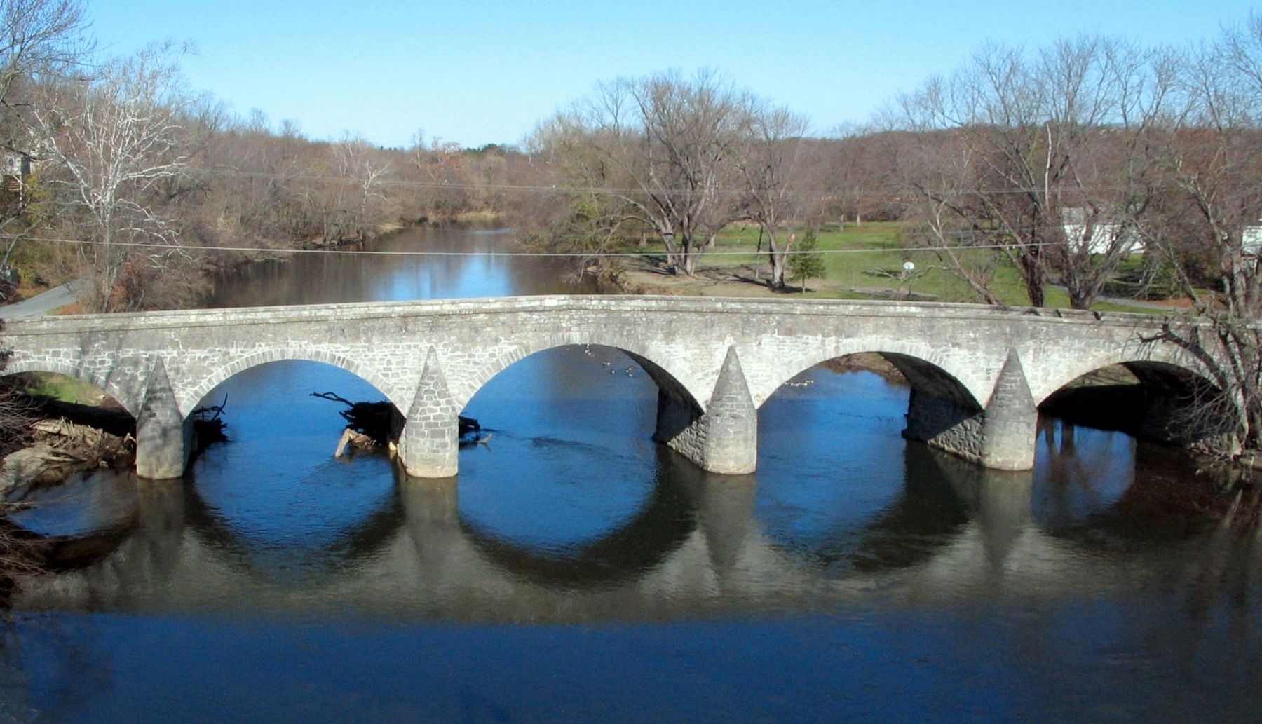
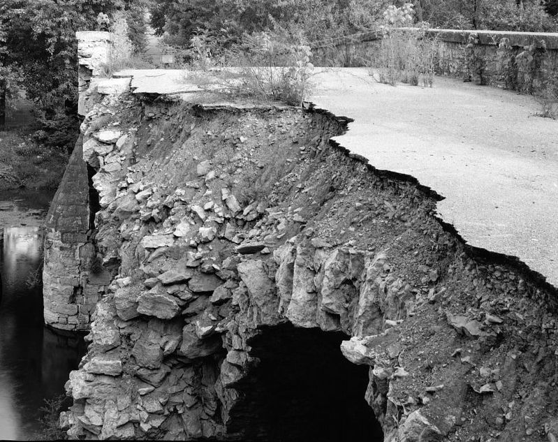
Built in 1819, this five-arch structure, named for nearby village, was first stone bridge in Washington County. Erected by Silas Harry at cost of $12,000, it was a major improvement to road system between Baltimore and Cumberland, providing continuous smooth surface from Eastern Seaboard to western wilderness. It is one of two oldest bridges remaining on the National Pike (first federally financed road in the U.S.). Wilson Bridge carried traffic until seriously damaged by storm flooding in 1972.
Placed on National Historic Register, 1982.
Erected by the Washington County Historical Society; the Maryland Historical Society; and the Washington County Committee, Maryland Historical Trust.
Topics and series. This historical marker is listed in these topic lists: Bridges & Viaducts • Roads & Vehicles. In addition, it is included in the The Historic National Road series list. A significant historical year for this entry is 1819.
Location. 39° 39.449′ N, 77° 50.763′ W. Marker is in Wilson-Conococheague, Maryland, in Washington County. Marker is at the intersection of Baltimore National Pike (U.S. 40) and Stone Bridge Drive, on the right when traveling west on Baltimore National Pike. Marker is just east of the current U.S. 40 Conococheague Bridge. Touch for map. Marker is at or near this postal address: 15112 Wilson Bridge Park Ln, Hagerstown MD 21740, United States of America. Touch for directions.
Other nearby markers. At least 5 other markers are within 2 miles of this marker, measured as the crow flies. A different marker also named Wilson Bridge (about 300 feet away, measured in a direct line); Gettysburg Campaign (approx. 0.3 miles away); Wilson’s Store (approx. 0.3 miles away); “The Bank Road” (approx. 0.7 miles away); a different marker also named Gettysburg Campaign (approx. 1.1 miles away).
More about this marker. One of the few Maryland roadside markers of this style with only one face. Back of marker is blank.
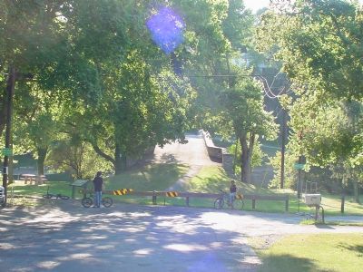
Regarding Wilson Bridge. Just beyond the marker is Wilson Bridge Park with parking and picnic tables under trees and a grassy bank along the river from which the bridge can be viewed.
Also see . . .
1. Wilson Bridge. (Submitted on November 18, 2006.)
2. Wilson's Bridge. (PDF) WA-V-001, National Register Form. (Submitted on October 30, 2016, by Allen C. Browne of Silver Spring, Maryland.)
3. Wilson Bridge. Route 40 Net. (Submitted on October 30, 2016, by Allen C. Browne of Silver Spring, Maryland.)
HABS - Library of Congress
8. Wilson Bridge
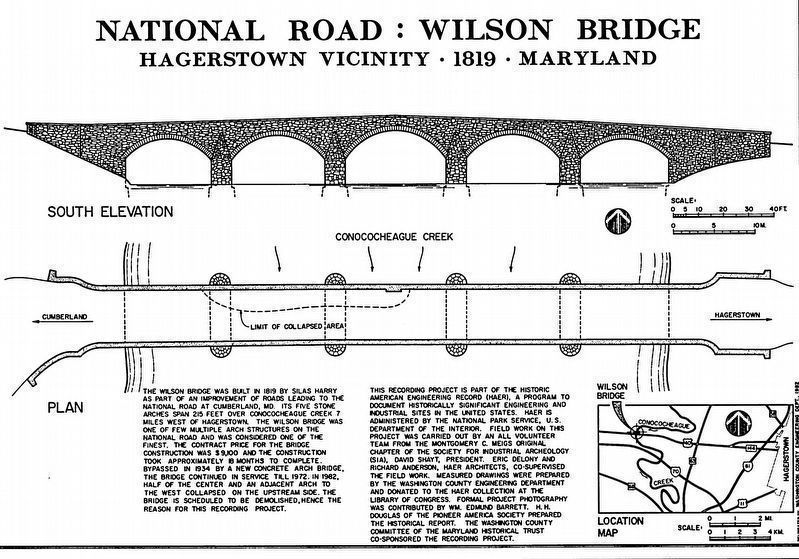
South Elevation & Plan view, showing collapsed roadway
South Elevation & Plan view, showing collapsed roadway
“The Wilson Bridge was built in 1819 by Silas Harry as part of an improvement of roads leading to the National Road at Cumberland, MD. Its five stone arches span 215 feet over Conococheaque Creek 7 miles west of Hagerstown. The Wilson Bridge was one of a few multiple arch structures on the National Road and was considered one of the finest. The contract price for the bridge was $9,100 and the construction took approximately 18 months to complete. Bypassed in 1934 by a new concrete arch bridge, the bridge continued in service until 1972. In 1982, half of the center and an adjacent arch to the west collapsed on the upstream side. The bridge is {1983} scheduled to be demolished, hence the reason for this recording project.”HABS Wilson Bridge Recording Project
Credits. This page was last revised on September 20, 2021. It was originally submitted on November 18, 2006, by J. J. Prats of Powell, Ohio. This page has been viewed 2,861 times since then and 12 times this year. Photos: 1, 2, 3. submitted on November 18, 2006, by J. J. Prats of Powell, Ohio. 4, 5, 6. submitted on October 30, 2016, by Allen C. Browne of Silver Spring, Maryland. 7, 8. submitted on November 1, 2016, by Allen C. Browne of Silver Spring, Maryland.
