Elkhart in Elkhart County, Indiana — The American Midwest (Great Lakes)
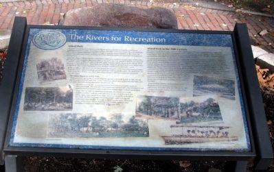
The Rivers for Recreation
Our Rivers' Story
Island Park
The island formed by the confluence of the Elkhart and St. Joseph Rivers could be said to be the birthplace of our community. According to folklore, the Native Americans living in the area named the Elkhart River, Mishiwa-Teki-Sipiwi (Heart of a Stag) because the island resembled an Elk's heart. No matter if the tale is true, what is most important is the island's beautiful setting between these graceful flowing rivers.
When the village of Elkhart was first established in 1831 there was plenty of open space so there was little interest in the island as a place of recreation. But as the city grew, people looked for new forms of recreation. As late as 1859, an editor of the daily paper, then describing a picnic on the "Island", felt it necessary to state its location. Since there was no bridge, the picnic goers hired a boat to deliver them to the island. That was the beginning of what the island would become years later, a park.
In the summer of 1882, the G.A.R. (Grand Army of the Republic), a Civil War veterans organization, leased the island, built a foot bridge and promoted the island as a public resort. The dedication was held on July 4th with Col. C.G. Conn, then mayor, giving an address to a crowd estimated to number 8,000.
The Island Becomes a City Park
Although an attempt by the city to purchase the property was made as early as 1881, the city did not acquire the land until 1887. It was at that time, the owners, James Rufus Beardsley and his sister, Sarah Davenport, deeded the island to the city.
By 1886 a new bridge was erected and the island had some limited success in attracting people. The Volunteer Fire Department had been given the refreshment and entertainment concession and was loaned six oil street lights to illuminate the park.
From 1891 to 1900 the island saw the greatest development as a park. In 1891 an artestian well was sunk and a colorful gazebo built over it (see photo, right). That well still flows today and is located on the north side of the island. In 1892 the bridge was replaced with a span from the old North Main Street Bridge. A circular pavilion was erected in 1893 at the center of the island. This pavilion was used for many political rallies including an address by William Jennings Bryan in 1896.
Island Park in the 20th Century
The island was still the premier center of outdoor gatherings in Elkhart as it entered the new century. The Chautauqua Society moved from McNaughton Park in 1991 and continued its lecture and recreational activities on the island. Although the popularity of Chautauquas waned by the 1930's the park continued to provide entertainment with weekly
Elkhart Municipal Band concerts and dances.
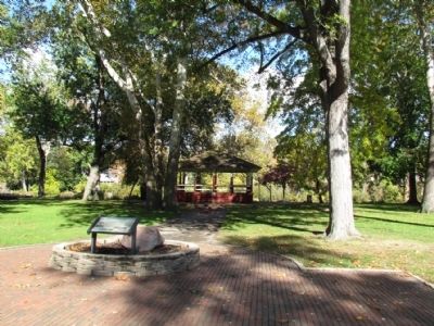
During the first part of the century there had not been any major improvements to Island Park. It was in 1937 that the WPA (Work Projects Administration), a federal program, began refurbishing the park. Over the next three years the older buildings were torn down or replaced. The artesian well gazebo was removed and the fountain redesigned. The round pavilion was destroyed, leaving the concrete pad for dancing. The picnic hall was dismantled, redesigned and rebuilt at the present location on the south side of the island (see photo, below). Additionally, a hollow area in the center of the island was filled. Throughout the years improvements have continued to be made, new playground equipment, erosion control, lighting, and two more bridges were added. The first bridge, installed in 1976, connects Island Park to Lundquist-Bicentennial Park on the south. The second, the Miles Centennial Bridge, built in 1984, spans the St. Joseph River on the north side. In 1980, the C.G. Conn Bandstand was dismantled at the company's factory site, moved and reconstructed in the center of the island.
Since 1979 the park has also been home to the Rhapsody in Green Festival, a summer musical celebration. Elkhartans today, like those in the 19th Century, still find themselves drawn to Island Park, the "heart" of Elkhart.
Topics and series.
This historical marker is listed in this topic list: Settlements & Settlers. In addition, it is included in the Works Progress Administration (WPA) projects series list. A significant historical month for this entry is July 1887.
Location. 41° 41.483′ N, 85° 58.261′ W. Marker has been reported unreadable. Marker is in Elkhart, Indiana, in Elkhart County. Marker can be reached from Pacific Street west of N. Elkhart Avenue. Marker is located on Island Park; you may park on Pacific Street in Lundquist Bicentennial Park and walk across the pedestrian bridge to the island. Touch for map. Marker is in this post office area: Elkhart IN 46514, United States of America. Touch for directions.
Other nearby markers. At least 8 other markers are within walking distance of this location. The Rivers and the Native Americans (about 300 feet away, measured in a direct line); Island Park (about 400 feet away); The Rivers for Industry (about 400 feet away); The Rivers for Commerce (about 800 feet away); Village of Pulaski (approx. 0.2 miles away); Ruthmere (approx. 0.2 miles away); Development of Diagnostic Test Strips (approx. 0.2 miles away); Elkhart River Wharves (approx. 0.2 miles away). Touch for a list and map of all markers in Elkhart.
More about this marker. As stated on the marker, the markers for Our Rivers' Story were designed and written by James Faigh, J. Faigh Design, Elkhart, IN.
Credits. This page was last revised on June 29, 2022. It was originally submitted on October 27, 2013, by Duane Hall of Abilene, Texas. This page has been viewed 519 times since then and 15 times this year. Last updated on June 19, 2022, by Trevor L Whited of Kokomo, Indiana. Photos: 1. submitted on October 27, 2013, by Duane Hall of Abilene, Texas. 2. submitted on June 19, 2022, by Trevor L Whited of Kokomo, Indiana. 3. submitted on October 27, 2013, by Duane Hall of Abilene, Texas. • Devry Becker Jones was the editor who published this page.


