Fresno in Fresno County, California — The American West (Pacific Coastal)
Site of Church-Sperry Mill and Mill Ditch
Inscription.
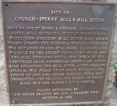
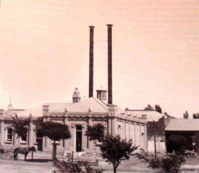
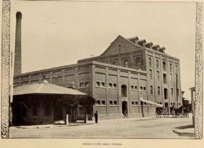
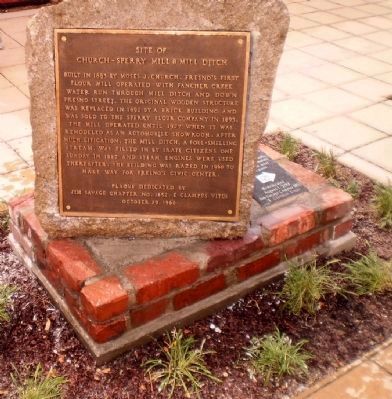
Built in 1883 by Moses J. Church, Fresno's first flour mill operated with Fancher Creek water run through Mill Ditch and down Fresno Street. The original wooden structure was replaced in 1892 by a brick building and was sold to the Sperry Flour Company in 1893, The mill operated until 1927 when it was remodeled as an automobile showroom. After much litigation, the Mill Ditch, a foul-smelling stream, was filled in by irate citizens one Sunday in 1887 and steam engines were used thereafter. The building was razed in 1960 to make way for Fresno's Civic Center.
Erected 1960 by Jim Savage Chapter No. 1852, E Clampus Vitus. (Marker Number 2.)
Topics and series. This historical marker is listed in these topic lists: Settlements & Settlers • Waterways & Vessels. In addition, it is included in the E Clampus Vitus series list. A significant historical year for this entry is 1883.
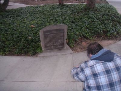
Location. 36° 44.355′ N, 119° 47.237′ W. Marker is in Fresno, California, in Fresno County. Marker is on Fresno Street, 0.1 miles north of O Street, on the right when traveling north. The marker was moved from its oritginal location at the intersection of Fresno and N Streets (36° 44.317′ N, 119° 47.25′) Win Eaton Plaza to the back door of the Fresno Water Tower. It was originally located in a flower bed within a grove of trees near the corner. Touch for map. Marker is at or near this postal address: 2444 Fresno Street, Fresno CA 93721, United States of America. Touch for directions.
Other nearby markers. At least 8 other markers are within walking distance of this marker. The Fresno Water Tower (here, next to this marker); George M. Bowman (here, next to this marker); Fresno Corridor of Flags Veterans Memorial (within shouting distance of this marker); Fresno Memorial Auditorium (within shouting distance of this marker); Via Liberation (approx. 0.2 miles away); Fresno (approx. 0.2 miles away); David of Sassoon (approx. 0.2 miles away); Fresno Technical School (approx. ¼ mile away). Touch for a list and map of all markers in Fresno.
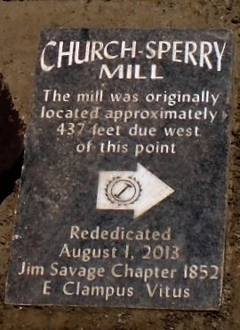
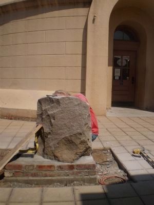
More about this marker. The marker was brass set on a small piece of granite. The City of Fresno indicated in 2009 that they were going to level the area the monument was located in, so E Clampus Vitus removed the marker in 2009 and re-installed it 437 feet away in 2013. The brass plaque has now been inlaid into the granite rock.
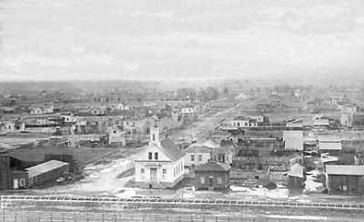
Regarding Site of Church-Sperry Mill and Mill Ditch. The Church ditches brought water to downtown, but also carried tainted water away from downtown. The ditches were narrow enough to jump across, but not every jump was successful. Many residents walked home from downtown reeking of smelly
ditch water.
Photographed By Lester J Letson, September 6, 2013
3. New Site of Church-Sperry Mill and Mill Ditch Marker
Marker was rededicated on September 6, 2013 just outside the back door of the Fresno Water Tower. A second re-dedication stone tells the story that the mill stood 437 feet west of the water tower.
Credits. This page was last revised on January 31, 2019. It was originally submitted on December 24, 2012, by Lester J Letson of Fresno, California. This page has been viewed 884 times since then and 40 times this year. Last updated on October 29, 2013, by Lester J Letson of Fresno, California. Photos: 1, 2. submitted on December 24, 2012, by Lester J Letson of Fresno, California. 3. submitted on October 29, 2013, by Lester J Letson of Fresno, California. 4, 5. submitted on December 24, 2012, by Lester J Letson of Fresno, California. 6. submitted on October 20, 2014, by Lester J Letson of Fresno, California. 7, 8. submitted on October 29, 2013, by Lester J Letson of Fresno, California. • Syd Whittle was the editor who published this page.
