Near Castella in Shasta County, California — The American West (Pacific Coastal)
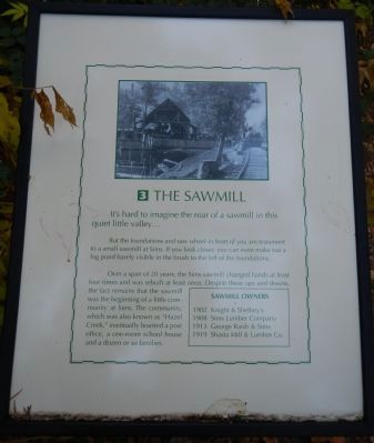
The Sawmill
But the foundations and saw wheel in front of you are testament to a small sawmill at Sims. If you look closer, you can even make out a log pond barely visible in the brush to the left of the foundations.
Over a span of 20 years, the Sims sawmill changed hands at least four times and was rebuilt at least once. Despite these ups and downs the fact remains that the sawmill was the beginning of a little community at Sims. The community, which was also known as “Hazel Creek,” eventually boasted a post office, a one-room school house and a dozen or so families.
(side bar:)
Sawmill Owners
1902 Knight & Shelbey’s
1908 Sims Lumber Company
1913 George Raish & Sons
1919 Shasta Mill & Lumber Co. (Marker Number 3.)
Topics. This historical marker is listed in these topic lists: Horticulture & Forestry • Industry & Commerce. A significant historical year for this entry is 1902.
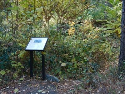
Location. 41° 3.648′ N, 122° 21.679′ W. Marker is near Castella, California, in Shasta County. Marker can be reached from Sims Road. The marker is located in the Sims Flat Forest Service campground, near camp site #13, at the east end on Sims Road, Exit 721 off Interstate 5. Touch for map . Marker is at or near this postal address: 26980 Sims Road, Castella CA 96017, United States of America. Touch for directions.
Other nearby markers. At least 8 other markers are within 11 miles of this marker, measured as the crow flies. CCC Camp (1934-1939) (within shouting distance of this marker); Water Tank (about 500 feet away, measured in a direct line); Sims Bridge: A CCC First (approx. 0.2 miles away); Southern Hotel and Stage Station (approx. 0.4 miles away); Battle Rock (approx. 6.4 miles away); A Relic from the Old Logging Days (approx. 6.4 miles away); Stone Turnpike Memorial Freeway (approx. 10.1 miles away); Klub Klondike (approx. 10.8 miles away). Touch for a list and map of all markers in Castella.
Credits. This page was last revised on June 16, 2016. It was originally submitted on October 30, 2013, by Barry Swackhamer of Brentwood, California. This page has been viewed 623 times since then and 13 times this year. Photos: 1, 2. submitted on October 30, 2013, by Barry Swackhamer of Brentwood, California. • Syd Whittle was the editor who published this page.

