Beaufort in Beaufort County, South Carolina — The American South (South Atlantic)
Battery Saxton
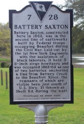
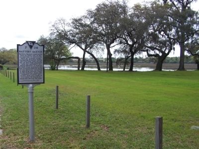
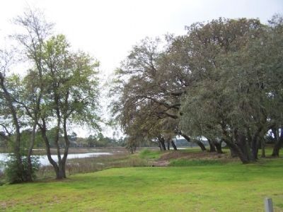
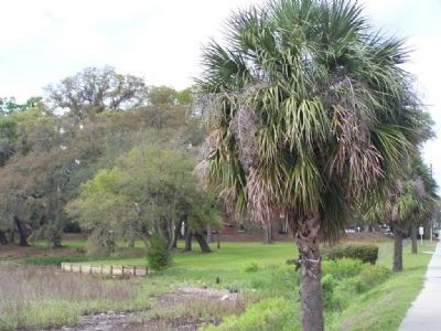
Battery Saxton, constructed here in 1862, was in the second line of earthworks built by Federal troops occupying Beaufort during the Civil War. Laid out by the 1st New York Engineers with the assistance of black laborers, it held 3 8 inch siege howitzers and was occupied 1862-65 as one of two batteries anchoring a line from Battery Creek to the Beaufort River, the remnants of which are visible here just south of U.S. Hwy. 21 (known as Shell Rd. during the war).
(Reverse Text):
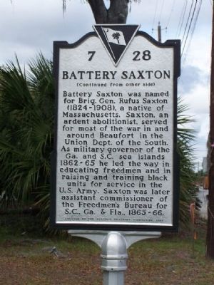
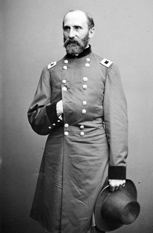
Battery Saxton was named for Brig. Gen. Rufus Saxton (1824-1908), a native of Massachusetts. Saxton, an ardent abolitionist, served for most of the war in and around Beaufort in the Union Dept. of the South. As military governor of the Ga. and S.C. sea islands 1862-65 he led the way in educating freedmen and in raising and training black units for service in the U.S. Army. Saxton was later assistant commissioner for the Freedmen's Bureau for S.C. and Ga. & Fla., 1865-66.
Erected 2001 by Historic Beaufort Foundation. (Marker Number 7-28.)
Topics. This historical marker is listed in these topic lists: African Americans • Forts and Castles • War, US Civil. A significant historical year for this entry is 1862.
Location. 32° 26.473′ N, 80° 42.005′ W. Marker is in Beaufort, South Carolina, in Beaufort County. Marker is on Boundary Street (U.S. 21), on the right when traveling east. Touch for map. Marker is in this post office area: Beaufort SC 29902, United States of America. Touch for directions.
Other nearby markers. At least 8 other markers are within 2 miles of this marker, measured as the crow flies. Beaufort (approx. 0.8 miles away); Address by President Lincoln (approx. 1.2 miles away); Beaufort National Cemetery (approx. 1.2 miles away); A National Cemetery System (approx. 1.2 miles away); Re-interred 19 African-American Civil War Volunteers (approx. 1.2 miles away); 1st SC Infantry Of African Descent (approx. 1.2 miles away); Beaufort Historic District (approx. 1.3 miles away); Stephen Elliott Jr (approx. 1½ miles away). Touch for a list and map of all markers in Beaufort.
Regarding Battery Saxton. National Register of Historic Places:
Camp Saxton Site *** (added 1995 - - #94001581)
Also known as 38BU163;See Also:Fort Frederick
♦ Address Restricted , Port Royal
♦ Historic Significance: Event
♦ Area of Significance: Black
♦ Period of Significance: 1850-1874
♦ Owner: Federal
♦ Historic Function: Defense, Landscape
♦ Historic Sub-function: Military Facility,
Also see . . .
1. General Saxton. His career included posts fighting Seminoles in Florida, teaching artillery tactics at the United States Military Academy at West Point, New York, surveying the uncharted Rocky Mountains on George McClellan's staff in advance of the Northern Pacific Railroad (1853). (Submitted on April 10, 2008, by Mike Stroud of Bluffton, South Carolina.)
2. National Register Information on Camp Sexton Site. The Camp Saxton Site is nationally significant as an intact portion of the camp occupied from early November 1862 to late January 1863 by the 1st South Carolina Volunteers, the first black regiment mustered into regular service in the United States Army during the Civil War, and as the site of the elaborate ceremonies held here on New Year’s Day 1863 which formally announced and celebrated the enactment of the Emancipation Proclamation freeing all slaves in areas then “in rebellion” against the United States. (Submitted on September 18, 2008, by Brian Scott of Anderson, South Carolina.)
Additional commentary.
1. General Rufus Saxton
From the Fort MacArthur Museum Association:
"Battery Saxton is named for Major General Rufus Saxton (1824-1908) a graduate of the US Military Academy at West Point class of 1849. Prior to the Civil War, Saxton fought against Seminole Indians in Florida, and as an artillery tactics instructor at West Point. During this period he also patented a self-registering thermostat for deep-sea soundings. During the Civil War he served on the staff of General McClellan and commanded the defenses of Harpers Ferry from May through June of 1862. For his actions there he would later be awarded the Congressional Medal of Honor for “Distinguished gallantry and good conduct in the defense”."
"After his service at Harpers Ferry, he was placed in charge of the enlistment and organization of negroes into the Union Army. After the war ended, Saxton was appointed as the Assistant Commissioner of the Freedman’s Bureau and spoke before Congress on the subject of civil rights for African Americans. Major General Saxton was forced to retire in 1888 having reached the mandatory retirement age of 65. He died on February 23, 1908 and is buried in the Arlington National Cemetery."
— Submitted April 10, 2008, by Mike Stroud of Bluffton, South Carolina.
Credits. This page was last revised on December 10, 2020. It was originally submitted on April 10, 2008, by Mike Stroud of Bluffton, South Carolina. This page has been viewed 2,271 times since then and 63 times this year. Photos: 1, 2, 3, 4, 5. submitted on April 10, 2008, by Mike Stroud of Bluffton, South Carolina. 6. submitted on December 9, 2020, by Allen C. Browne of Silver Spring, Maryland. • Craig Swain was the editor who published this page.
