Near Montague in Siskiyou County, California — The American West (Pacific Coastal)
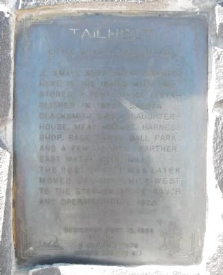
Tailholt
Little Shasta Post Office
Erected 1984 by E Clampus Vitus, Humbug Chapter 73.
Topics and series. This historical marker is listed in this topic list: Settlements & Settlers. In addition, it is included in the E Clampus Vitus, and the Postal Mail and Philately series lists. A significant historical year for this entry is 1920.
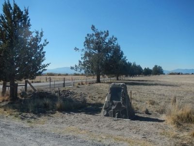
Location. 41° 43.594′ N, 122° 22.176′ W. Marker is near Montague, California, in Siskiyou County. Marker is at the intersection of Snowden Hovey Gulch Road and Ball Mountain Road on Snowden Hovey Gulch Road. Touch for map. Marker is at or near this postal address: 1 Snowden Hovey Gulch Road, Montague CA 96064, United States of America. Touch for directions.
Other nearby markers. At least 8 other markers are within 11 miles of this marker, measured as the crow flies. Little Shasta Congregational Church (approx. 1˝ miles away); Yreka Trail - Splendid Roads (approx. 4.1 miles away); Yreka Trail - Down Shasta Valley (approx. 5.7 miles away); Schmitt Brothers Mill (approx. 6.3 miles away); Yreka Trail - The Snelling Ranch (approx. 7˝ miles away); Montague (approx. 8.2 miles away); Yreka Trail - Shasta River (approx. 8.9 miles away); All Roads Lead to Ager Stage and Freight Stop (approx. 10.7 miles away). Touch for a list and map of all markers in Montague.
More about this marker. This marker is located approximately 8 miles east of Montague.
Credits. This page was last revised on June 16, 2016. It was originally submitted on October 31, 2013, by Barry Swackhamer of Brentwood, California. This page has been viewed 628 times since then and 19 times this year. Photos: 1, 2. submitted on October 31, 2013, by Barry Swackhamer of Brentwood, California. • Syd Whittle was the editor who published this page.

