Montague in Siskiyou County, California — The American West (Pacific Coastal)
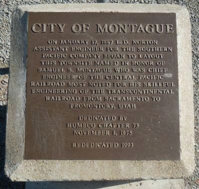
Montague
Erected 1975 by E Clampus Vitus, Humbug Chapter 73.
Topics and series. This historical marker is listed in these topic lists: Railroads & Streetcars • Settlements & Settlers. In addition, it is included in the E Clampus Vitus series list. A significant historical month for this entry is January 1559.
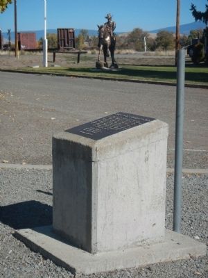
Location. 41° 43.652′ N, 122° 31.675′ W. Marker is in Montague, California, in Siskiyou County. Marker is at the intersection of South 11th Street (California Route 3) and East Webb Street, on the left when traveling south on South 11th Street. This marker is located in Railroad Park. Touch for map. Marker is at or near this postal address: 146 South 11th Street, Montague CA 96064, United States of America. Touch for directions.
Other nearby markers. At least 8 other markers are within 6 miles of this marker, measured as the crow flies. Yreka Trail - Shasta River (approx. 2.6 miles away); Yreka Chinese Cemetery (approx. 4.6 miles away); Yreka Trail - Our Journeys End (approx. 4.7 miles away); Yreka Western (approx. 5.3 miles away); Frogtown (approx. 5.4 miles away); Gas Works (approx. 5˝ miles away); Site of Yreka Inn / Site of Dr. Daniel Ream Ranch (approx. 5.6 miles away); The Greathouse/DeWitt Building (approx. 5.6 miles away).
Also see . . . City of Montague. Traveling in wagons, early immigrants settled in the Shasta Valley in the early 1850s. These early homesteaders staked out their land and made the area their home. (Submitted on October 31, 2013, by Barry Swackhamer of Brentwood, California.)
Credits. This page was last revised on June 16, 2016. It was originally submitted on October 31, 2013, by Barry Swackhamer of Brentwood, California. This page has been viewed 530 times since then and 21 times this year. Photos: 1, 2, 3. submitted on October 31, 2013, by Barry Swackhamer of Brentwood, California. • Syd Whittle was the editor who published this page.


