Near Nancy in Pulaski County, Kentucky — The American South (East South Central)
The Dawn of Battle
The Battle — 6:00 A.M.
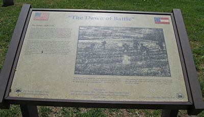
Then, through the rain and foggy early morning light, the first Confederate troops, the 15th Mississippi, 20th Tennessee, and the 19th Tennessee regiments of General Zollicoffer's brigade, came over the hill in front of you in line of battle on both sides of the road and moved to attack the newly formed Union line. On the west side of the road (your right) the 19th Tennesssee engaged the Union forces. While on this side of the road, the 15th Mississippi and the 20th Tennessee filed into the ravine to your left and rear, occupying most of its length. Later during the battle they would repeatedly charge from this ravine to attack the Union line.
(illustrations)
The marker includes a drawing on the right: "Sunday morning at daylight the Cavalry ran upon the enemies pickets one and one half mile out in their front. A few shots were exchanged and the enemy slowly fell back to his main line." — W.J. Worsham, 19th Tennessee Infantry, CSA
"After marching all night through a misty January rain, just as the gray dawn appeared in the East, we heard fire from the Federal pickets as they fired on our advance." — James Binford, 15th Mississippi Infantry, CSA.
Erected 1997 by Mill Springs Battlefield Association.
Topics. This historical marker is listed in this topic list: War, US Civil.
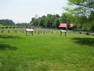
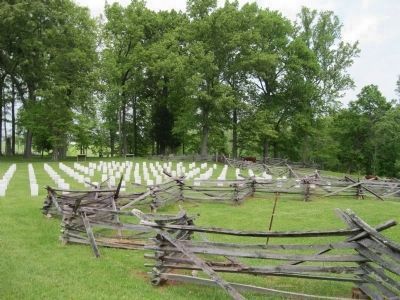
Location. This marker has been replaced by another marker nearby. It was located near 37° 3.318′ N, 84° 44.346′ W. Marker was near Nancy, Kentucky, in Pulaski County. Marker could be reached from Kentucky Route 235, 0.1 miles south of Kentucky Route 761, on the left when traveling south. Marker is at Tour Stop 2: "Confederate Cemetery" of the Mill Springs Battlefield Driving Tour on the north edge of a field of symbolic Confederate grave markers. Touch for map. Marker was in this post office area: Nancy KY 42544, United States of America. Touch for directions.
Other nearby markers. At least 8 other markers are within walking distance of this location. "Confederate Mass Grave" (here, next to this marker); a different marker also named Dawn of Battle (here, next to this marker); Confederate Dead
(a few steps from this marker); Confederate Mass Grave Memorial (a few steps from this marker); Gen'l Felix K. Zollicoffer (within shouting distance of this marker); Mill Springs Battlefield (within shouting distance of this marker); Victory! (within shouting distance of this marker); A Fatal Mistake (within shouting distance of this marker). Touch for a list and map of all markers in Nancy.
More about this marker. This marker was replaced by a new one named Dawn of Battle (see nearby markers).
Credits. This page was last revised on August 2, 2019. It was originally submitted on November 6, 2013, by David Graff of Halifax, Nova Scotia. This page has been viewed 545 times since then and 12 times this year. Photos: 1, 2, 3. submitted on November 6, 2013, by David Graff of Halifax, Nova Scotia. • Bernard Fisher was the editor who published this page.


