Fort Lee in Prince George County, Virginia — The American South (Mid-Atlantic)
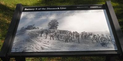
Battery 8 of the Dimmock Line
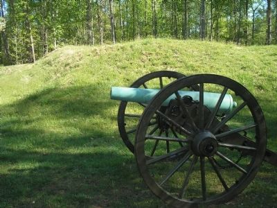
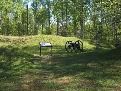
After capturing this section of the Dimmock Line, the Federals incorporated parts of it, including Battery 8, into a second line of siege works. Battery 8 would see combat only one more time, when Union guns here helped repel the Confederate breakthrough at Fort Stedman in March 1865.
Erected by Petersburg National Battlefield - National Park Service - Dept of the Interior.
Topics. This historical marker is listed in this topic list: War, US Civil. A significant historical month for this entry is March 1865.
Location. 37° 14.186′ N, 77° 21.479′ W. Marker is in Fort Lee, Virginia, in Prince George County. Marker is on Siege Road, on the right when traveling south. Marker is in Petersburg National Battlefield on the Auto Tour Road at Tour Stop 2. Touch for map. Marker is in this post office area: Fort Lee VA 23801, United States of America. Touch for directions.
Other nearby markers. At least 8 other markers are within walking distance of this marker. “A Splendid Charge” (approx. 0.3 miles away); Infantry Earthworks (approx. 0.3 miles away); Monotonous Toil (approx. 0.3 miles away); U.S. Colored Troops (approx. 0.3 miles away); Dividing Point (approx. 0.4 miles away); Confederate Battery 6 (approx. half a mile away); Jordan Family Cemetery (approx. half a mile away); Stephen Tyng Mather (approx. half a mile away). Touch for a list and map of all markers in Fort Lee.
More about this marker. The background of the marker is a war-time photograph with the caption, This photo, taken from a point across the tour road to your right, shows Battery 8 (in the background) five days after its capture by the Federals. In the coming weeks, Confederate Battery 8 would be demolished by the Federals and replaced by the redan you see today.
Also see . . .
1. The Siege of Petersburg. (Submitted on April 12, 2008, by Bill Coughlin of Woodland Park, New Jersey.)
2. Petersburg National Battlefield. National Park Service. (Submitted on April 12, 2008, by Bill Coughlin of Woodland Park, New Jersey.)

Photographed By Bill Coughlin, April 23, 2007
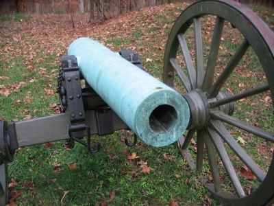
3. Battery 8 Artillery
The artillery located inside of Fort Friend (Battery 8) participated in the defense of Fort Stedman in March 25, 1865. This particular artillery piece is a Confederate 3-inch Rifle cast by A.B. Reading and Brothers, of Vicksburg, Mississippi in 1862.
Credits. This page was last revised on August 22, 2021. It was originally submitted on April 12, 2008, by Bill Coughlin of Woodland Park, New Jersey. This page has been viewed 1,441 times since then and 29 times this year. Photos: 1, 2, 3. submitted on April 12, 2008, by Bill Coughlin of Woodland Park, New Jersey. 4. submitted on December 22, 2008, by Craig Swain of Leesburg, Virginia. • Craig Swain was the editor who published this page.


