Callahan in Siskiyou County, California — The American West (Pacific Coastal)
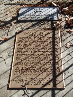
Tacitus Ryland Arbuckle
(Founder of the town of Arbuckle)
Erected 1984 by E Clampus Vitus, Montain Charlie Chapter 1850.
Topics and series. This historical marker is listed in these topic lists: Cemeteries & Burial Sites • Settlements & Settlers. In addition, it is included in the E Clampus Vitus series list. A significant historical month for this entry is March 1852.
Location. 41° 21.18′ N, 122° 49.262′ W. Marker is in Callahan, California, in Siskiyou County . Marker can be reached from East Callahan Road (County Route 3), on the left when traveling south. Touch for map. Marker is at or near this postal address: 8020 East Callahan Road, Callahan CA 96014, United States of America. Touch for directions.
Other nearby markers. At least 8 other markers are within 8 miles of this marker, measured as the crow flies. Farrington Blacksmith Shop (approx. 3.2 miles away); Hayden Hotel (approx. 3.2 miles away); Church of Saints John & Paul (approx. 3.4 miles away); McBride Ranch (approx. 5.4 miles away); Etna Cemetery Veterans Memorial (approx. 8 miles away); Hallie Morse Daggett (approx. 8 miles away); John Daggett (approx. 8 miles away); Stephen H. Meek (approx. 8.1 miles away). Touch for a list and map of all markers in Callahan.
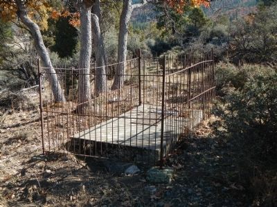
More about this marker. The Tacitus Arbuckle grave site and marker are on private property. The address and GPS coordinates are for the property entrance only and not for the actual grave site.
Also see . . . Arbuckle - Colusa County website. It was laid out and surveyed in 1875 and it was named after Tacitus Ryland Arbuckle, on whose ranch, then consisting of 1,900 acres, the town was built. He encouraged the creation of a new town here by giving lots to those who would build on them. (Submitted on November 18, 2013, by Barry Swackhamer of Brentwood, California.)
Credits. This page was last revised on June 16, 2016. It was originally submitted on November 18, 2013, by Barry Swackhamer of Brentwood, California. This page has been viewed 644 times since then and 46 times this year. Photos: 1, 2. submitted on November 18, 2013, by Barry Swackhamer of Brentwood, California. • Syd Whittle was the editor who published this page.

