Keene in Cheshire County, New Hampshire — The American Northeast (New England)
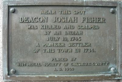
Deacon Josiah Fisher
Erected 1930 by Historical Society of Cheshire County.
Topics. This historical marker is listed in these topic lists: Colonial Era • Native Americans • Settlements & Settlers • Wars, US Indian. A significant historical date for this entry is July 10, 1904.
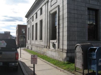
Location. 42° 55.995′ N, 72° 16.769′ W. Marker is in Keene, New Hampshire, in Cheshire County. Marker can be reached from the intersection of West Street and Federal Street. The marker is on the left rear of the building at 34 West St. It can be seen from Federal St. Touch for map. Marker is at or near this postal address: 34 West St, Keene NH 03431, United States of America. Touch for directions.
Other nearby markers. At least 8 other markers are within walking distance of this marker. Jonathan Myrick Daniels (within shouting distance of this marker); Keene Remembers (about 300 feet away, measured in a direct line); Civil War Memorial (about 300 feet away); Barry Faulkner, Muralist (about 400 feet away); The Railroad (about 400 feet away); The United Church of Christ in Keene (about 500 feet away); Magical History Tour (about 500 feet away); Industrial Heritage Trail (about 600 feet away). Touch for a list and map of all markers in Keene.
Credits. This page was last revised on October 21, 2020. It was originally submitted on November 20, 2013, by Tony Farrick of Shelburne Falls, Ma.. This page has been viewed 627 times since then and 25 times this year. Photos: 1, 2. submitted on November 20, 2013, by Tony Farrick of Shelburne Falls, Ma.. • Bill Pfingsten was the editor who published this page.

