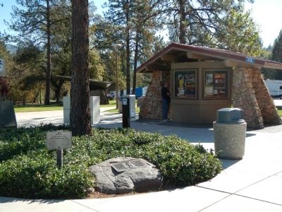
Lakehead-Lakeshore in Shasta County, California — The American West (Pacific Coastal)
Stone Turnpike Memorial Freeway
Inscription.
Until 1860 only a dangerous pack trail through the upper Sacramento River Canyon linked Oregon with California’s northern mines. Yreka’s merchants and settlers also wanted a safer wagon road.
The rugged terrain defied road building efforts until the Upper Soda Springs-Pitt River Turnpike Company built 44 miles of road from Upper Soda Springs (North Dunsmuir) to Stone’s Pitt River Ferry (now under Lake Shasta).
Elias Stone, born in Pittsford, N.Y., founded his turnpike company with sons Norton, Willard, Lloyd, Marvin, and William plus kinsmen Edwin Stone and Pembroke Murray.
The road builders used man- and animal-power plus black powder to carve a road along the canyon walls. Twenty-one log bridges were sited by block and tackle above all high-water marks.
South from Soda Springs the road ran along the west bank via Dog Town, Hales Ferry (Antlers), east over the ridge to McCloud River, then to Pitt River and Stone’s Ferry. Another road lead to Shasta, ‘Queen City of the Northern Mines'.
The fierce winter storms of 1860 washed out most of the road. Undaunted, the Stones in 1861 rebuilt their toll road but again they suffered setbacks as torrential rain again flooded the canyon.
The company struggled on with low tolls, high repair costs and legal problems. In 1868 new owners took over.
After 1870, use of competing routes declined as freight teamsters, U.S. Mails, and stage drivers used Stone’s more direct road. In the 1880s, the Central Pacific laid rails to Oregon using some of the old Stone turnpike roadbeds.
Stones’ route was later paved as the Pacific Highway. Upgraded, it became U.S. 99, and in the 1960s, was rebuilt as Interstate 5.
In 1862, a Geological Survey leader enroute to Mount Shasta wrote “...most picturesque road I have ever traveled. Sometimes down to the level of the river – sometimes crossing ridges, sinking into ravines – sometimes a narrow way where two wagons cannot pass for half a mile... the road is pretty well engineered ...”
Up and Down California
1860 – 1864
Erected 1995 by Descendants of Elias Stone and Deacon Simon Stone.
Topics. This historical marker is listed in this topic list: Roads & Vehicles. A significant historical year for this entry is 1860.
Location. 40° 55.041′ N, 122° 23.887′ W. Marker is in Lakehead-Lakeshore, California, in Shasta County. Marker is on Interstate 5, on the right when traveling south. Touch for map. Marker is in this post office area: Lakehead CA 96051, United States of America. Touch for directions.
Other nearby markers. At least 8 other markers are within 12 miles of this marker, measured as the crow flies. Klub Klondike (approx. 1.1 miles away); a different marker also named Stone Turnpike Memorial Freeway (approx. 9½ miles away); Water Tank (approx. 10 miles away); The Sawmill (approx. 10.1 miles away); CCC Camp (1934-1939) (approx. 10.1 miles away); Sims Bridge: A CCC First (approx. 10.3 miles away); Southern Hotel and Stage Station (approx. 10½ miles away); Pioneers Who “Held the Ribbons” (approx. 11.9 miles away).
More about this marker. This marker is located at the southbound Interstate 5 roadside rest area between exits 707 and 704.
Credits. This page was last revised on June 16, 2016. It was originally submitted on November 20, 2013, by Barry Swackhamer of Brentwood, California. This page has been viewed 4,097 times since then and 72 times this year. Photos: 1, 2. submitted on November 20, 2013, by Barry Swackhamer of Brentwood, California. • Syd Whittle was the editor who published this page.

